Leaderboard


Popular Content
Showing content with the highest reputation on 06/05/2016 in Posts
-
Hello, all, This will serve as a formal forum announcement that we have released the version 3.2 update for SkyMaxx Pro. All customers who have purchased SkyMaxx Pro v3 up till now have been sent an e-mail by X-Aviation with complete instructions on how to obtain your update. We have made this a very simple process! For those that purchase SkyMaxx Pro v3 from today forward, your purchased download will already be updated to version 3.2 for you. If you're a Real Weather Connector customer then new changes will be included in this update that will greatly enhance your experience. What if I didn't get the update e-mail? If you did not receive your update e-mail don't fret! X-Aviation has updated our system to allow all customers to update with ease, regardless of whether you received an e-mail for the update! Here's what to do: 1. Login to your X-Aviation account here: https://www.x-aviation.com/catalog/account_history.php 2. Find your original SkyMaxx Pro 3 download and re-download it. It will download as the latest version! There are some important fixes and requests implemented in this update. The following is a list of additions/fixes included: What's New / Changed: Cloud detail level is now set automatically based on the cloud draw area in SMP's settings, to maximize performance with large draw areas. High-altitude jetliner pilots will want to try turning up the draw area for fast clouds that extend further, and look better, than ever. X-Plane 10.50-ready; uses new 10.50 features to further improve performance. Added 3 new cirrus cloud texture sets Less VRAM usage from clouds Removed min & max cloud size settings Edges of cumulus cloud layers are now rounded instead of square Cumulus clouds are very slightly darker More performance improvements Cirrus cloud lighting refined Cirrus clouds no longer "jump" periodically Updated documentation If you're a Real Weather Connector customer, further enhancements include: New "Never change visible weather" option in the RWC configuration dialog ensures the weather around you stays constant, as you fly into the latest updated weather seamlessly. Avoids reloading of clouds when crossing 1-degree tile boundaries Properly handles missing RVR data in METAR reports (fixes issues with no clouds appearing near some automated weather stations) Automatically enforces a minimum cloud draw area when RWC is active Clouds are no longer reloaded if a new METAR file is found, yet its data is unchanged. METAR data is now always reloaded when RWC settings are changed Cloud layer heights now more accurate As always, thanks for being a customer with X-Aviation. We appreciate your feedback and support! Enjoy these latest updates, and stay tuned to the forum as we continually announce the latest happenings.3 points
-
OK, I see what's going on here. METAR cloud heights are specified as AGL (above ground level,) but in X-Plane we need to draw them in MSL (above mean sea level.) To convert between the two, SMP 3.2 tests the height of the terrain underneath you to figure out where "ground level" is. Problem is, if you're flying over mountainous terrain or over islands, ground level changes frequently, and that's what's leading to the cirrus cloud moving like it does. Coding up a fix now.3 points
-
Just read through this post... and I'm absolutely amazed by the feedback and interaction from IXEG. And the fact that you actually share some info with regards to your bug fixing and issue resolution processes. Well done... keep it up.2 points
-
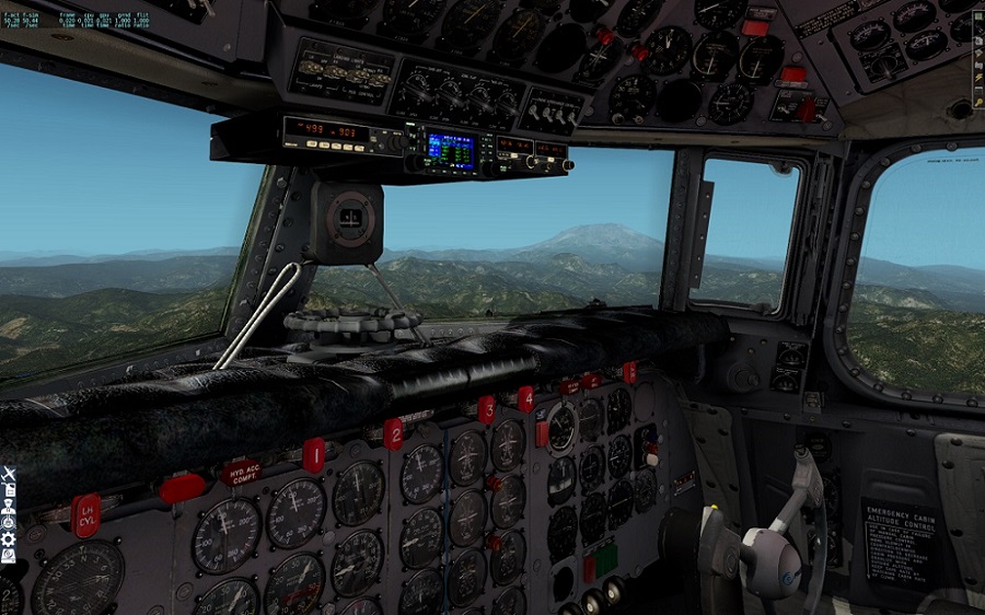
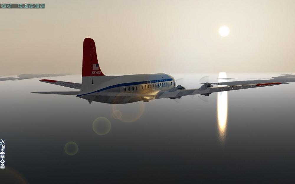
The tutorial flight for the PMDG DC-6 has you going from KPDX to KSEA. An enjoyable short hop, 53 minutes including taxi time. From 8000', here's a view of Mt. Adams.
 2 points
 -
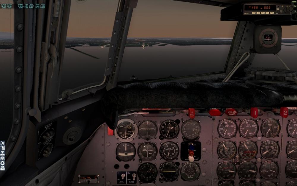
Hi all, a first look at PMDGs DC-6!1 point
-
Out of KBOS to CYYZ. Second flight UMMS to EFTP

 1 point
 -
KSEA - CYVR
 1 point
 -
Those moments when you realize you haven't posted anything even though you pressed "submit reply" but you have butterfingers...So Im not going to try and retype everything I did originally, haha, DTW is in a constant state of progression. Everyday I am knocking out tasks which get me closer to showcasing something. Here are 2 pics of the Flight 255 memorial. Located here via Google maps https://www.google.com/maps/place/Northwest+Airlines+Flight+255+Memorial/@42.2418294,-83.3274813,61m/data=!3m1!1e3!4m5!3m4!1s0x883b4928f7ac5441:0xa80ec1c7c6100361!8m2!3d42.2418388!4d-83.3273424 ---Visiting the memorial it was a somewhat rough experience for me. I have never been to the site of an air disaster or it's memorial and it was a very humbling moment. Really neat If you are in Detroit and have the chance to check it out.1 point
-
Hello Using this one http://www.helgo11335.de/index.html http://www.helgo11335.de/Downloads/Mallorca_9.1.zip1 point
-
Just to follow up, I took the time today to reproduce your exact scenario. It was more complex than I assumed; basically the weather stations around Juneau were reporting conditions that were all over the map, creating many cumulus cloud layers at widely different altitudes intersecting the stratus layers at widely different altitudes. It was a very tough set of conditions for RWC to make sense of. I've coded up some changes that will handle something like this better in our next update, though.1 point
-
@Cameron could you close this thread before I get hundreds of dislikes?1 point
-
If you removed RWC, you'll need to download the latest version of it and re-install it as well. If the real world weather option is missing in the SMP config menu, it means RWC is not properly installed (or there is some sort of license authentication issue going on.)1 point
-
Hehe, the places you people fly to! Thanks for the report - it is the same iteration of the known bug, where the FMS is having a tough time with conditional waypoints and their desired direction... Jan1 point
-
Hi Julian, I will doublecheck with my cockpit videos, but I am pretty certain that the FD master lights extinguish when an AP is in CMD. Thanks, Jan1 point
-
Hi and thanks for the report -- I have never seen this, but could think of a few causes: The N1 should go to the value specified on the TAKEOFF REF page - depending on environmental factors, a derate or thrust reduction selected this could be between 83 and 93% (or so). If the A/T is not achieving this N1 after pushing the TO/GA buttons, it is most likely because either the THR HOLD speed is reached before the A/T is done (this is at 84kts), or because the users joystick is interfering. This would happen if you move the joystick thrust lever down a bit during the takeoff run. The logic interprets this as an attempt to reject the takeoff, and the thrust control is handed back to the joystick thrust lever. To avoid this, follow the procedure that we suggest in the tutorials: After pushing TO/GA buttons, advance your joystick thrust lever ALL THE WAY FORWAR TO THE STOPS immediately. Don´t try to follow the "ghost throttles" or try to adjust to the correct position. All the way forward very rapidly, then don´t touch them. Let me know if this helps, Jan1 point
-
Update failed: there is something different between your sims : 1.0.4 vs 1.0.5, X Plane 10.36 vs X Plane 10.45, xjoymap.ini vs no xjoymap.ini, lua script, or something else creating commands or datarefs. Can't find DataRef: this is only a warning in the log file Waiting for a readme included in the .zip, here is a checklist: Before the connection Same state of the plane. fuel, payload, CG, Cold and dark, Turn Around, Ready to fly. After the connection If cold and dark, don't use the carts, APU only. Elevator trim with joystick button only (no mouse). Airbrakes with mouse, joystick button, keyboard (no axis). Guards and gear door are not synchronized. Each pilot have to open/close them. smartco 1.4.3.zip1 point
-
Your log confirms it's associated with crossing tile boundaries, combined with impossible cloud layer altitudes in the METAR data that RWC struggled to compensate for. You must have been flying across the corners of adjacent tiles for it to happen that often. Thanks for the data; it gives me something to work with. Cute dog.1 point
-
You only needed to install SMP. Lack of activation dialog would be correct if you already have a valid license.1 point
-
Yes, it's intersecting cloud layers in the METAR data. SMP tries to prevent this by moving them around if necessary; I think what happened is that by increasing the cloud draw area, it caused SMP to produce larger cloud puffs, and so it actually needed to move them more than before to avoid this sort of thing. It should be a fairly rare occurrence and specific to certain cloud draw area settings and weather conditions, but in the meantime switching SMP's overcast representation setting to sparse or dense particles should avoid this anomaly entirely. I will make a change for SMP 3.2.1 however to avoid this case better regardless of settings. Thanks for including your log.txt; it made this very easy to pinpoint.1 point
-
In the preferences of squawkbox, you will see render distance near the bottom as well. It'll say something like "max render distance for full plane"1 point
-
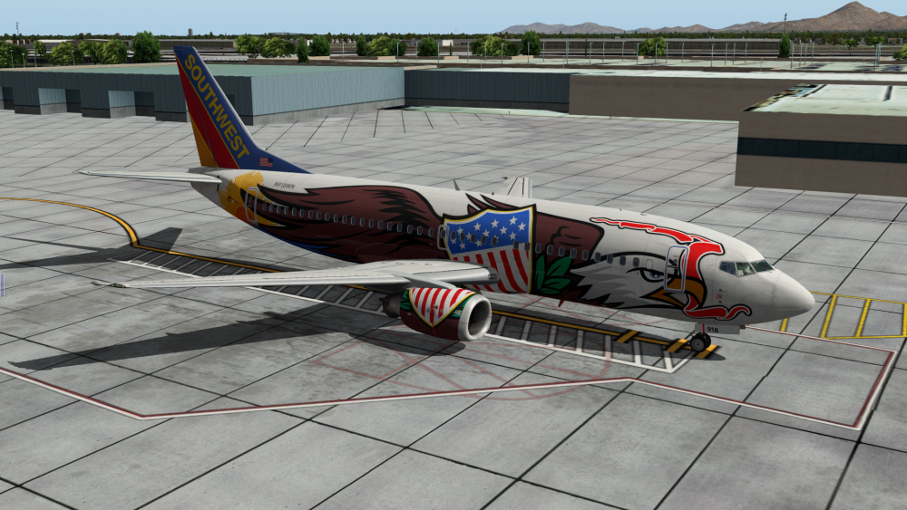
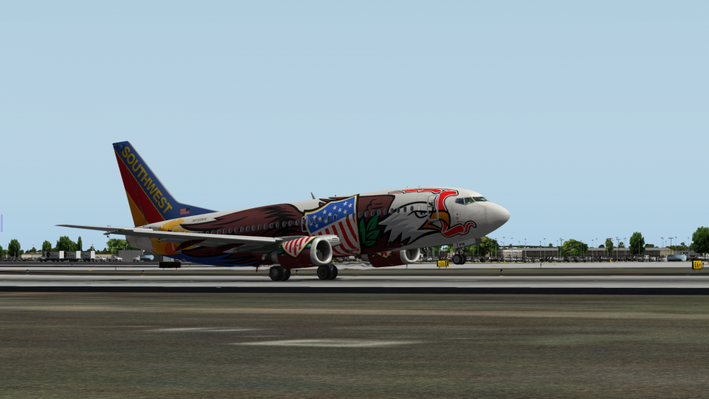
Painting Southwest livery and testing it at KPHX
 1 point
 -
LUKK to LHDC
 1 point
 -
I heard that too I thought it is intended and is caused by gusting wind... But maybe that's wrong... Sebastian1 point
-
Landing in EDDL coming from EIDW...
 1 point
 -
Hi, cannot seem to find a question in your post?1 point


.thumb.jpg.ede78836fe6795baf7b91e5eb2aad35e.jpg)