


reflic
-
Posts
55 -
Joined
-
Last visited
Content Type
Profiles
Forums
Latest X-Plane & Community News
Events
Downloads
Store
Everything posted by reflic
-
ok thanks! i was just wondering if Groundhandling was interfering with it!
-
Is there supposed to be alt callouts in the SAAB? I never get callouts if there are supposed to be them, like 50, 40, 30, etc or minimums
-
If you want to avoid the vnav hassles from what I've experienced. You have to get rid of those above altitudes in your FMC especially if you're using navigraph, the plane will never meet a restriction with the above waypoints right now from my experience. But I know they'll fix it in the coming weeks. So say Instead of 17000A just put 17000 and you will decend fine, below restrictions work really well too.
-
Is the IXEG 733 too sensible in wind direction/speed changes ?
reflic replied to cmbaviator's topic in General Discussion
In my opinion you're doing way too much aileron correction which would explain the roll. -
 Incredible detail, and a dedicated painter!
 -
lol thanks!
-
@Celis lol i hate to keep bothering you but....you forgot to paint the inside of the winglit with the logo..should be a simple swap like the tail..but i thought you should know.
-
Nevermind i see it under the screenshot! thanks again celis
-
hey Celis, i think the file for the updated southwest livery is still the old one, redownloaded it and my winglits are the same.
-
Celis, you are the man!
-
hey @celis did you manage to knock out those winglits? nice alaska livery! also im nit picking again, but i hope you like the criticism haha. but you forgot to do the logo on the inside the winglits for alaska's new livery i know its a NG but unless you used a diff tail for the ref? anyways hope i helped
-
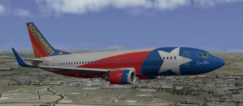
You are AMAZING!!! thanks so much dude!, i just have one question not trying to be nit picky but..are you going to paint the winglits with the southwest logo? i know its still WIP so just asking..again thank you so much! and heres a Ref pic if you need it
-
Can someone do the Southwest lonestar please!
-
Wow thanks for that awesome explanation!
-
Well maybe I should ask first, what does the aircraft want to do if a way point has a restriction that is a Above symbol. For example let's say we're decending from 31,000 feet and I Donno waypoint A has a restriction of 16,000A, and the next way point is a 14,000 restriction 15 miles away how would the plane theoretically handle that? I'm not really sure how the terminology is for A and B. Except I know it's above and below
-
I checked out the tutorials, but i didn't see (or i couldn't find) this particular question. Why is it when my STAR has a waypoint that say is 14,000A. I know this is the symbol for Above, but if i execute this procedure, on any VNAV decent, the aircraft will never meet the restriction, one time it passed the way point 10,000 ft above the way point, and the VNAV path sky rocketed down to like 6,000 ft/min. If i do a 14,000B everything works as it should.
-
Is the weather radar giving accurate returns? I mostly see Green/yellow, i put it to +2 on climb and -2 on cruise/decent. is that how it is supposed to look? i'm spoiled with another developers weather radar which is why i ask.
-
I aw someone do this on a stream, they had a checklist besides the one that comes with the aircraft on the clickly. How could you do this?
-
- 1
-

-
i didn't see anything in the documentation tutorials for this. Or i missed it, but do i just hit APP at the transition for the RNAV? and then its good?
-
Nevermind! turn on WX then press TER button
-
Not sure, but i select the button TERRAIN under the FMC and nothing is populating the bottom screen with terrain data, is that implemented yet?
-
I mean like....its moving left to right.like someone is doing it intentionally..is that seriously normal..
-
Every time i load this aircraft, the rudder is constantly moving left, and right (on its own, like a ghost is driving it..and no the AI is not piloting the plane, and i checked my controls)...why does this happen.