
DSF Scenery Packages
145 files
-

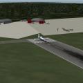
Tingwall - Shetlands - EGET
By Countdown
WELCOME TO TINGWALL AIRPORT SHETLAND ISLANDS -- EGET
Tingwall Airport (IATA: LWK, ICAO: EGET), also known as Lerwick/Tingwall Airport, is located in the Tingwall valley, near the village of Gott, 4 NM (7.4 km; 4.6 mi) northwest of Lerwick on the mainland island of the Shetland, Scotland. Although it is the nearest airport to Lerwick, it is not Shetland's main airport. Shetland's main airport is at Sumburgh.
Source WIKI
Tingwall (EGET) airport was opened on the 20th of October 1976 by the then-councillor J.J. Johnson to replace the grass strip which existed slightly further south down the Tingwall Valley. The aerodrome is owned and operated by the Shetland Islands Council, to provide a base for inter-island air services to Foula, Fair Isle, Out Skerries and Papa Stour. There were also formerly flights to Unst and Fetlar by BN-2B Islander aircraft, and to Edinburgh by DeHavilland DHC-6 Twin-Otter aircraft, which still operate services to the Hebrides from there.
The sole aircraft hangar on the airport existed originally at Sumburgh Airport (EGPB) until it was dismantled and rebuilt on the tarmac apron at Tingwall.
Loganair held the contracts for inter-island air-transport flights and air ambulance flights both from the outer isles to the Shetland Mainland, and from Shetland to Aberdeen with several BN-2B Islander aircraft based at Tingwall, Kirkwall and Glasgow. Recently, the air-ambulance contract was awarded to Gama Aviation, who operate Beechcraft Kingair-200 aircraft (Based in Aberdeen) and a Sumburgh-based Aerospatiale AS-332L2 Puma helicopter which combines outer-isles air-ambulance duties with its main role as a standby rescue helicopter for offshore installations in the North Sea. There is also an Inverness-based Eurocopter EC-135 rescue helicopter which has seen regular use in outer-isles patient-transfers. Directflight Ltd was awarded the inter-island air-transport contract by the Shetland Islands Council, who had bought a new Islander - G-SICA and a refurbished ex-police Islander G-SICB for the new contract. The Sumburgh-based coastguard rescue helicopter (Formerly the Bristow Helicopters-operated Sikorsky S-61 G-CGOC, affectionately known as 'Oscar Charlie' locally, now a Sikorsky S-92 series - G-SARC and G-CGOC among others) also use Tingwall as the closest airfield to the Gilbert Bain Hospital in Lerwick to land patients from the Isles, offshore vessels and even oil installations. The Coastguard contract was recently awarded to CHC-Scotia, who brought the S-92s to the isles to replace the ageing S-61. The runway is 764M x 18M asphalt, with approach lights (to the South), obstacle lights, runway side, end, threshold and apron lights. Precision Approach Path Indicators (PAPIs) for both directions are available. There is a Flight Information Service available to aircraft between 0830 and 1700 (Local time) Mon-Fri and 1030-1500 (Local) on Saturdays during the summer months on 125.300MHz. A non-directional beacon (NDB) operates permanently on 376KHz adjacent to the runway. Avgas 100LL is available from the firemen/attendants during opening hours, and an aerodrome fire/rescue service to Cat-1 (Also Cat-2 on remission) is manned during opening hours. There has been one fatal crash at Tingwall during its history, when an Islander returning from Aberdeen after a successful air-ambulance flight in May 1996 crashed approx 1500M South of the field in bad weather, fatally wounding the pilot and injuring a doctor and nurse who were aboard at the time. The AAIB report can be found here: http://forums.x-plan...&showfile=12836
Instructions
Unzip and put into Custom Scenery - simple as that.
This airport is, I hope, a replica of the real thing. I have also put in some surrounding area details, with a few surprises. Use rendering option-"airport detail extreme-roads extreme" (if not you will miss out on road lighting),
For the purists like me who know there are not that many trees on the Shetlands I have put some roads in if you select no roads.
The HDR effects are quite nice so try a night flight as well.
117 downloads
0 comments
Submitted
-

KOWK Central Maine Airport of Norridgewock
Nothing too fancy, here. KOWK is a pretty basic little GA airport in Central Maine. This airport holds a little sentimentality for me as a personal favorite for my Dad and I to fly to from nearby KWVL. It is also a little known fact that the Maine Criminal Justice Academy utilizes the airfield for their Emergency Vehicle Operations Course multiple times a year.
I am still learning the ins and outs of WED but I attempted to make the package as realistic as possible using opensceneryx objects. The layout is largely accurate though buildings are plausible approximations. I have a lot of, "real life," experience with this airport and think it looks pretty good and certainly better than a couple of blank runways and an apron.
Thank you to Brian Godwin for his continued assistance and encouragement.
60 downloads
0 comments
Submitted
-

KFMY - Page Field - Fort Myers, Florida
By 3TB
Page Field (KFMY) is a popular GA airport in Fort Myers, Florida. If you are into GA flying, or business jets as large as 727s, this is the hub for you. Page Field is also a great airport for cross country flying. Located in Southwestern Florida, it's easily accessible to Orlando, Lakeland, Tampa, St. Pete, Palm Beach, Vero, Miami, Key West, Naples, and it's nearby companion, KRSW. My goal was to make this airport as realistic as possible for the sake of "feeling at home" and for practicing IFR cross country procedures.
Contents
Completely accurate airport layout
26 Custom Objects, accurately representing facilities including Base Ops (FBO), hangars, tarmac layout, parking lots, etc.
Multiple starting points for single/multi-prop and jets, including hangar space and tie-down spots.
Starting points on all runway entrances.
Global lighting attached to every building.
Accurate, named ATC paths
Taxiway and Runway signs
Most up-to-date Airport Diagram (PDF)
Requires
X-Plane 10
OpenSceneryX for aircraft population only (can be removed using WED 1.2)
Object Rendering Settings at "tons" for full airport
To Do List (for future version)
Bump Maps on all objects
Finish modeling 5 remaining hangars
Model surrounding shopping centers, etc.
Ortho-photo of all grassy areas on airport premises
This is my first airport scenery for X-Plane. I used WED 1.2, Blender 2.63, and Photoshop. I am grateful for so many of you who have posted invaluable how-to information. Please let me know if you have any issues or problems. Also, if you would like to use any of my custom objects, please feel free--and let me know! I'd also be happy to customize any, if I am able.
226 downloads
Submitted
-

Glenelg, South Australia (Near YPAD)
By skyflyer
Glenelg, South Australia Photo Scenery (near YPAD)
ISDG (International Scenery Development Group)
v1.1
It is hard to take off or land at YPAD without seeing the cosmopolitan buzz of Glenelg, its Marina and beachfront. Here is a 15cm/pixel orthophoto of this area, SW of YPAD.
This has been designed as a further enhancement of YPAD from our recent package: YPAD Adelaide Airport Photoreal (XP10) 1.1
System Requirements:
X Plane 10.20 or better (64 bit recommended).
a modern video card, minimum 512Mb of VRAM, but with YPAD package also loaded I would suggest a 1GB VRAM minimum, with settings on "Very High" with compression.
Essential Libraries:
•OpenSceneryX
•RuScenery.zip
•Flags of the World
UPDATE v1.1
January 28 2013
• 3d objects added:
- Big thanks to Andyrooc for his custom made Glenelg Jetty and Stamford Grand, especially for this package.
_ Big thanks to Ropeless for creating the Norfolk Island Pines and other trees, essential for Glenelg!
– Aussie flags added to pier
– other objects added from OpensceneryX and ruscenery
all are required (except for OpensceneryX which has a placeholder) or this package will crash X-plane!
Contact us @ X-Pilot.com:
chris k
ropeless
skyflyer
sethesus
Karinga
__________________________________________________________
Other ISDG Group Member Sceneries:
YSSY Sydney Australia - http://forums.x-pilot.com/index.php/files/file/78-yssy-sydney-australia-airport-photo-scenery-xp10/
YSCN Camden Australia - http://forums.x-plane.org/index.php?app=downloads&showfile=14867
NZCH Christchurch NZ - http://forums.x-pilot.com/index.php/files/file/122-nzch-christchurch-airport-photo-scenery-xp10-isdg/
KPDX Portland OR USA - http://forums.x-plane.org/index.php?app=downloads&showfile=11248
KRMN Stafford VA USA - http://forums.x-plane.org/index.php?app=downloads&showfile=15638
__________________________________________________________
Copyright © 2013 by the ISDG (International Scenery Development Group)
212 downloads
Updated
-

KGRR - Grand Rapids
By briangodwin
Sorry for the quick revision, but it is well worth it. I received an unexpected message and gift from a community member...objects that he had modeled for this airport. I am humbled and of course added them for the whole community to enjoy. Thank you AndrooC!
This is KGRR Grand Rapids, MI. The package also includes Y70, a field which caters to gliding enthusiasts. Both fields were requested by fellow X-Planer Dave Robertson (check out his AWESOME XPlane videos on YouTube "redpiper1").
Features:
This version:
Modeled and textured feature canopy and ATCT
Road tweaks to enable automobile flow through the terminal area and parking garage (I know it's eye-candy...this will be enhanced once OSM data is updated)
Previous version:
Version 10 Only
Full ATC (no flows yet) at KGRR
GI lighting at both KGRR and Y70
"New" apron lights
Graduated LOD terminal objects
Plane spotting pad at KGRR
Modifications:
The underlying airport data for KGRR is largely the default from XP10. I only tweaked some of the hard surfaces around the terminal area to accommodate objects.
Y70 is built from the ground up as it only had a runway and a computer generated taxiway. Minimal GI lighting has been added for aesthetics.
Issues:
It seems it wouldn't be right unless I had a glitch with the fenced parking facade. This time, even though my facade is aligned with the underlying pavement using "snap vertices" it still refuses render a whole segment properly. This is on the most northwest parking area (just ignore it) :-)
Credit shout outs:
AndrooC for the totally awesome and unexpected graciousness of the canopy and ATCT that up the visual appeal of the airport 1000%
All scenery designers regardless of talent, that inspire us to advance the XPlane experience
The whole LR team with special thanks to the art/texture person (I don't know who it is by name)
OpenSceneryX for objects
Finally, Dave Robertson both for the inspiration of this package and for modifying the base XP texture file so that we have a little variety on the apron lights now. Yes, the package is a little bigger than it would be because we had to mod and copy the texture files. We couldn't replace the original nor add it to the library…but we hope that LR will hear the plea already sent and include this in future releases as "stock". Until then, other designers feel free to use the hacked object and textures in your own projects. At least credit Dave…my hacking the object was easy. :-)
Constructive criticism/comments are always welcome. If you want to just gripe, please remember that people like me do this for the enjoyment (hence, the purchase price). Enjoy it or not, the choice is yours.
331 downloads
Updated
-

C77 Poplar Grove Illinois Photoreal
By chris k
C77 Poplar Grove Photoreal
Version 1.0, Jan 04, 2013
By: Chris K and the ISDG Group
This scenery was made in request from a user named Becky Lynn, who is a new XP10 user (but not new to flying!) who was very surprised that nobody had taken this cute fly-in / live-in residential airport and updated it's taxiways since the beginning of time.
I was about to walk through a quick learn tutorial with WED, but since this was a one-off, I decided to quickly update the taxiways myself. Since I had WED open anyways, I also decided to give it the "Photo Underlay" Treatment and spruce it up with some standard XP10 library objects at the same time. (Hangars, FBOs, etc.)
Took about 2 hours to get done.
Nothing fancy.
Enjoy!
______________________________________
INSTALLATION:
Copy to your /Custom Scenery/ Folder.
______________________________________
IMAGERY CREDIT:
Orthophotos courtesy of the United States Geological Survey (USGS)
The dataset uses the 30cm/pixel USGS HiRes Orthoimagery
This Imagery is in the Public Domain as per:
http://cumulus.cr.us...listofortho.php
Copyrights and Credits
USGS-authored or produced data and information are considered to be in the U.S. public domain.
When using information from USGS information products [chrisk: which I am], publications, or Web sites, proper credit must be given.
Credit is provided by including the following citation:
Credit: U.S. Geological Survey
Department of the Interior/USGS
The USGS home page is http://www.usgs.gov.
______________________________________
NOTES:
- Uses 4096x4096 textures and pure XP10 Library - Sorry XP9 Users....
- Includes the earth.wed.xml project for anyone who wished to improve upon this.
- I hereby release this scenery into the public domain and allow any and all derivative works to anyone who chooses to do so.
______________________________________
145 downloads
Updated
-

KSEA Seattle Photoreal Underlay
By chris k
KSEA Seattle Photoreal Underlay
Version 0.1
Dec 27, 2012
Chris K and the ISDG Group
__________________________________________________________
Tired of Flying around the plain textured KSEA Demo Airport?
Feel Like filling your VRAM and Tanking your FPS at the same time?
Hate having trees in-line with your approaches?
You're downloading the right file!
Note: This is for XP10 as it uses 4096 x 4096 Textures for fast rendering
__________________________________________________________
Orthophotos courtesy of the United States Geological Survey (USGS)
The dataset is the 30cm/pixel USGS HiRes Orthoimagery
This Imagery is in the Public Domain as per:
http://cumulus.cr.usgs.gov/listofortho.php
Copyrights and Credits
USGS-authored or produced data and information are considered to be in the U.S. public domain. When using information from USGS information products (chrisk - which we are), publications, or Web sites, we ask that proper credit be given. Credit is provided by including the following citation:
Credit: U.S. Geological Survey
Department of the Interior/USGS
The USGS home page is http://www.usgs.gov.
__________________________________________________________
677 downloads
Updated
-

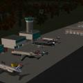
NOLF Imperial Beach (KNRS)
By ThePrivateer
RuScenery is required for this package! Get it here: http://www.x-plane.su/projects/ruscenery.html.
As a follow-on to my earlier NALF San Clemente Island, I give you one of my favirite scenery packages: Naval Outlying Landing Field Imperial Beach, located in Imperial Beach, California (just south of San Diego). From GlobalSecurity.org:
"OLF Imperial Beach is located nine miles south of the City of San Diego, between Imperial Beach and the Mexican Border. OLF Imperial Beach consists of approximately 1,100 acres and is the only exclusive-use Naval helicopter airfield on the West Coast. It serves as a practice field for Pacific Fleet helicopters and is utilized by 11 squadrons of combat and patrol helicopters. The principle function of OLF Imperial Beach is to provide landing practice training for Pacific Fleet aviation personnel. Navy helicopters based at North Island, Naval Air Station (NAS) routinely fly to OLF Imperial Beach to conduct training and practice operations."
The runways are very short here, so good luck trying to do ops in fighter aircraft. The Helicopter Capital of the World is recreated in detail for X-Plane for the first time, and I hope you all have as much fun flying in and out of it as I did. Have fun!
84 downloads
0 comments
Submitted
-
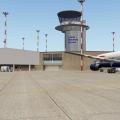
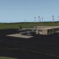
Sumburgh Airport - Shetlands
By Countdown
Welcome to Sumburgh Airport
Sumburgh Airport (IATA: LSI, ICAO: EGPB) is the main airport serving Shetland in Scotland. It is located on the southern tip of the mainland, 17 NM (31 km; 20 mi) south of Lerwick.[1] The airport is owned by Highlands and Islands Airports Limited (HIAL) and served by Loganair (under franchise to FlyBe) as well as sometimes seasonally by Atlantic Airways.
The airport is unusual in that it has a 550 m (1,804 ft) helicopter runway as opposed to usual helipad. The western end of runway 09 crosses the A970 road between Sumburgh and the northern mainland; access is controlled by a level crossing with barriers lowered whenever a flight is taking off or landing.
Sumburgh Links was surveyed and the grass strips laid out by Capt. E. E. Fresson in 1936: the Airport was opened on June 3 of that year with the inaugural flight from Aberdeen (Kintore) by the De Havilland Dragon Rapide G-ACPN piloted by Fresson himself. It was also one of the first airfields to have RDF facilities due to the frequency of low cloud and fog coupled with the proximity of Sumburgh Head. The building of runways was at the instigation of Capt. Fresson who had proved to the Navy at Hatson that to maintain all round landing facilities over the winter months runways were essential. This was taken up by the RAF after the obvious success of the Hatson (Orkney) experiment.
The former RAF Sumburgh airfield had two runways, the longest being 800 yd (730 m), and the shorter running a length of 600 yd (550 m) from shore-line to shore-line. No. 404 Squadron operated Beaufighter Mark VI and X aircraft from this station on coastal raids against Axis shipping off the coast of Norway and in the North Sea.
On 1 April 1995, ownership of the Company transferred from the UK Civil Aviation Authority to the Secretary of State for Scotland and subsequently to the Scottish Ministers.
Shetland is the home of otters, puffins & Shetland ponies.
Sumburgh airport is the main airport serving Shetland and is situated approximately 25 miles south from the main town/port of Lerwick. The airport provides air links to Scotland's major cities, Orkney and Norway.
Shetland is known for its distinctiveness and culture which is unlike that of anywhere else. Its roots lie deep in Viking with islands littered with Old Norse names and remains. It is a haven for birds being home to more than one million during the seasons. The Islands are also famous for great walking, cycling and touring, whale watching - Shetland Ponies and Fair Isle Knitwear to name but a few!
Opening Hours
Monday to Friday
06.30 - 20.30
Saturday
07.15 - 16.30
Sunday
10.15 - 20.30
Ok - So why did I give you the opening times - well because I search fairly extensively for night flight landings and found none, but then I realised that Shetland gets dark very early in winter - so next time you fly into Sumburgh in the dark - make a video!
I need to thank some people
Marginal - as ever I would be lost without your overlay editor, and other invaluable tools.
I started with World Editor, so thanks to Ben at the org for allowing us to use this package.
The Baron will always get a mention - he was my inspiration and got me back into designing, so thanks to him.
VERY IMPORTANTLY - a huge thanks to Iain Murray of Scotflight. He allowed me to use his Sumburgh terminal obj, with lit textures. The guy was so helpful he even offered to make me a mini Sumburgh scenery. FSX designers are great people.
Lastly - my wife whose patience knows no limits, supplier of tea and sympathy!
YOU WILL NEED
opensceneryx latest version.
turn up our airport detail settings to extreme for best results
not tried it in v8 but am almost sure it won't work there.
ALL MY OWN WORK - apart from the terminal obj.
209 downloads
0 comments
Submitted
-
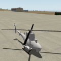
NALF San Clemente Island (KNUC)
By ThePrivateer
This is a small & simple version of Naval Auxiliary Landing Field San Clemente Island, located on an officially uninhabited island off the coast of Southern California. From Wikipedia:
"One of the primary military function of San Clemente has been to support research and development of many of the Navy's weapon systems. In 1939, the Navy developed the first Landing Craft, Vehicle and Personnel (LCVP) "Higgins Boat" at SCI. This was the beginning of the Naval Amphibious Force, which was one of the key factors in the outcome of World War II. Today SCI's primary function is twofold: (1) to support tactical training of the Pacific Fleet, and (2) to continue as a key research and development facility. SCI provides the Navy and Marine Corps a multi-threat warfare training range. A major part of Navy training takes place on the ranges right off the SCI shores. The primary range covers over 149,000 square miles (386,000 km²) and is the Navy's busiest Fleet airspace. Also included in this training area are two mine exercise areas, the Southern California Anti-Submarine Warfare Range, seven submarine areas, the shallow water Undersea Training Range, and two laser training ranges. In total, SCI is a unique combination of airfields, airspace and ranges unlike any other facility owned by the Navy. It is the only location in the Pacific where surface ships, submarines, aircraft and Navy expeditionary forces can train in all warfare areas simultaneously using shore gunnery, bombardment, air defense, anti sub and electronic warfare."
My rendition of NUC doesn't really cover the entire island; just the area immediately surrounding the airport. It's a good training area for naval aircraft such as the FA-18, EA-6B, AH-1, or P-8A, and many real-life Navy pilots consider it to be one of the most demanding training fields in the country due to the high crosswinds and difficult terrain. Also, this package features the first ever MQ-8B Fire Scout helicopter to be publicly available in the X-Plane world. Have fun!
111 downloads
0 comments
Submitted
-

Aerobridge-Meigs Field
By Peter T.
KCGX is now available for v9 and v10.
Aerobridge Studios-Meigs Field
Developed and designed by : Peter Tram, John Spahn, Juan Menedez
Manual : Peter Tram
Photography: Online resources
Version 2.0
Merrill C. Meigs Field Airport (IATA: CGX, ICAO: KCGX) was a single strip airport that operated from December 1948 until March 2003. It was built on Northerly Island, the man-made peninsula that was also the site of the 1933–1934 Century of Progress in Chicago. The airport achieved international notoriety when Chicago Mayor Richard M. Daley ordered city crews to bulldoze the runway at night, and without the 30-day advance warning required by FAA regulations.
From Wikipedia
This release is a major update to the first release
Features:
- Photorealistic ground
- Highly detailed airport buildings.
- Photorealistic textures
- Realistic asphalt textures in runways and taxiways
- Real-world airport lighting shades
- Main buildings include real night textures
- Authentic Vegetation
Support:
Please contact us by emailing to aerobridge1nfo@gmail.com
or by questioning us here on X-Pilot
LICENSE AGREEMENT:
Aerobridge Studios reserves all rights.Educational use, business use or
commercial use, without a proper license is prohibited. Please contact
us for license arrangements.Copying content for personal or other use
not covered by the license is prohibited.
2,953 downloads
Updated
-
KELM, Elmira Corning Regional Airport
By 79carboy
A scenery put together for my X-UNYS (Upstate New York Scenery project) Series. This will be my 9th scenery finished out of 15. Uses AndrooC's XAirportScenery files.
Made in X-Plane 9.70. Happy Landings!
Links
XAirportScenery: http://forums.x-plane.org/index.php?app=downloads&showfile=17534
X-UNYS:
Website http://upstatenewyorkscenery.webs.com/
134 downloads
0 comments
Updated
-

KFLL - Fort Lauderdale
By Ryan M.
This is my Fort Lauderdale scenery! I have finished adding the objects in, and I do have 100% permission to post.
You need to have opensceneryx for this to work.
Please enjoy.
DO NOT REDISTRIBUTE WITHOUT MY PERMISSION.
354 downloads
Updated
-
EGNM
By Countdown
Leeds Bradford - EGNM
You will need opensceneryx2, and FF_LIBRARY to take advantage of all of the scenery additions.
I took an old MSFS conversion done by Mr 3D and totally reworked it to bring it into the V10.20B5 world. It is my local airport and has changed significantly from the one Mr 3D converted years ago. The Baron is my inspiration, as he takes little known and underloved airports and brings them into the 21 century.
I like lots of lighting effects, but in this conversion I tried to keep to what is actually there, so I spend weeks tweaking the airport with google maps and microsoft bing maps as my guide.
Hope you like the airport. All my own work, and done with Mr 3D's blessing.
272 downloads
Updated
-

6B9, Skaneatleas Aero Drome
By 79carboy
A scenery put together for my X-UNYS (Upstate New York Scenery project)
Uses opensceneryX
Links:
X-UNYS Website: http://upstatenewyorkscenery.webs.com/
36 downloads
0 comments
Updated
-

5B2, Saratoga County Airport
By 79carboy
A scenery put together for my X-UNYS (Upstate New York Scenery Project)
Uses opensceneryX
LINKS:
X-UNYS Website: http://upstatenewyorkscenery.webs.com/
26 downloads
0 comments
Updated
-

4NY8,Harris Hill Soaring Club
By 79carboy
A scenery put together for my X-UNYS (Upstate New York Scenery project)
Uses opensceneryX
LINKS:
X-UNYS Website: http://upstatenewyorkscenery.webs.com/
34 downloads
0 comments
Updated
-
D38 Canandaigua, NY (v9)
By 79carboy
Scenery put together for my X-UNYS (Upstate New York Scenery project)
LINKS:
X-UNYS Scenery Website: http://upstatenewyorkscenery.webs.com/
27 downloads
0 comments
Updated
-

YPAD Adelaide Airport Photoreal (XP10)
By chris k
YPAD Adelaide Airport Photoreal Scenery (XP10)
Version 1.3 Release
Mar 03, 2013
__________________________________________________________
Features:
Photo-realistic terrain at 15cm/pix resolution
Accurately modeled Taxiways, Tarmac, Markings, and Signage
Accurately modeled Control Towers and Field Support buildings
Complete X-Plane 10 Compliant ATC/AI Taxi Flow System
Accurately Modeled Airport grounds and 3D Object placement
Customized HDR Lighting w/accurate light-stand models and positions
Customized HDR Lit Windsocks for landing visibility
Customized Terminal Entrance and Passenger drop-off zone Signage
Customized Gate Number Lighting
Customized Hangars and Localized Signage
Customized Runway Hold-Short Lighting
Animated Jetways and Autogate DGS System (xp10_32bit only for now)
Animated Terminal Doppler Radar
Animated Service Vehicles
Accurate Field Obstacles, Gables, and Bollards
Custom Forests, Trees, Vegetation, Grass, and Reeds
Customized (Non-Autogen) Terminal Roadway Lighting
Current Advertising and Billboard Signage
Downtown Adelaide (CBD) Buildings
Custom vehicles, parking lots, and associated vehicle HDR lighting
Accurate Helipads, Lighting, Markings, and Training Areas
Full "Gritty" Texture Support
And most important... 4 Different Restaurants to Choose From! (See if you can find them all)
_________________________________________________________
New in 1.2:
Removed artifact on orthophoto (Tile 12-6 near terminal gate).
Refactored ISDGLibrary
__________________________________________________________
New in 1.3:
New taxiway and runway edge grass; Gives a nice soft touch to the scenery.
Replaced Windsocks with Australian Style Windsocks w/HDR Lighting.
Added new Long Grass and Reed Areas via Facades; Little-to-no FPS Impact.
Added Yellow Warning lighting in key ares (Incursion Hotspots as per AIP)
Added guidance markers for main tarmac/ramp entrance/exit areas
Updated ISDG Library
Updated Autogate 1.40 (with LIT night textures)
__________________________________________________________
Scenery and 3D Object work:
Copyright © 2012-2013 by the ISDG (International Scenery Development Group)
All other derived materials are Copyright their respective rights holders, used with permission.
__________________________________________________________
Who Are We:
Ropeless - Orthophoto Guru, ATC Taxi Flow Master, HDR Lighting Overlord, and Photoshopping Machine.
SkyFlyer - Photoshopping, 3D Signage and Modelling, Stenciller, and our Local "Man on the Ground" who owns a nice camera.
Sethesus - 3D Modeller, Animations, and Johnny-on-the-spot for most of the custom objects you see.
Chris K - WED Addict, Taxiway paver, Object Rotator, Scenery Assembler, Gardener.
__________________________________________________________
Derived Object and Scenery Credits:
- Barry (Baz) Roberts: Original AussiePak1 Objects fixed for XP10 and re-textured
- GaryBKK (Gary): Containers and Ships
- Walterblenny (Al): AWSS Tower
- Nearmap.com: Orthophotos under Free Derivative Creative Commons Licence
ISDGLibrary/Forests/tree_textures:
Copyrights are owned by Andras Fabian, Albert Laubi, and Laminar Research. They are used unmodified with permission of Andras Fabian.
See ISDGLibrary/Forests/tree_textures/README.txt
ISDGLibrary/Forests/grass:
Contains material produced by "Simon W.".
Used under the licence implied in:
ISDGLibrary/Forests/grass/How to grow grass.pdf
ISDGLibrary/Objects/vehicles:
Car and truck objects sourced from "Vehicle Library Extension" http://forums.x-plan...showfile=16812.
Also in "New auto traffic" http://forums.x-plan...showfile=15244.
Used with permission from Jeff M. (Joyfulsongsters) and Cami de Bellis.
See ISDGLibrary/Objects/vehicles/README.txt
__________________________________________________________
Requirements:
- X-Plane 10.20 or better (http://wiki.x-plane.com/beta)
We know the art library in the 10.20 beta runs may change, if it does, we'll issue a fix.
- OpensceneryX 2.0 (http://opensceneryx.com/)
- A Modern Video Card with MINIMUM 512Mb VRAM.
This scenery (Plus X-Plane 10) use ~500 Mb of VRAM when loaded at "very high" with compression enabled.
- You will want to run this scenery at "very high" or "extreme" Texture Resolution.
- X-Plane 10.20 64-bit and 1 Gb VRAM Video card is recommended for the Higher Texture resolutions.
- Charts for YPAD: http://www.airservic...com/aip/aip.asp
__________________________________________________________
This scenery is designed to work best with:
Vehicle Library Extension (http://forums.x-pilo...n-xp9xp10-isdg/)
FlyJSim Asphalt Textures (http://forums.x-plan...&showfile=16270)
SkyMAXX sky colouring using "Vivid Skies" (http://forums.x-plan...&showfile=15821)
BeachMAXX Ocean Textures (http://forums.x-plan...&showfile=17311)
Autogate DGS System (http://forums.x-plan...s&showfile=5038)
Wide Taxiway Line Markings (http://forums.x-pilot.com/index.php/files/file/406-wide-taxiway-markings-library-replacement/)
__________________________________________________________
Still to fix:
- Some buildings are still a little too "glow in the dark" at night.
These are converts from AussiePak1 which were toned down, but could use some better lighting.
- Lost the edge grass facade functionality in the 10.20 betas. Bug report submitted.
__________________________________________________________
License:
This scenery is Postcard-Ware. Send us a postcard if you like the work! We'd love to hear from you.
See the included README.RTF for our address.
__________________________________________________________
Contact us @ X-Pilot.com:
chris k
ropeless
skyflyer
sethesus
karingka
__________________________________________________________
Other ISDG Group Member's Sceneries:
YSSY Sydney Australia - http://forums.x-pilot.com/index.php/files/file/78-yssy-sydney-australia-airport-photo-scenery-xp10/
YSCN Camden Australia - http://forums.x-plan...&showfile=14867
NZCH Christchurch NZ - http://forums.x-pilot.com/index.php/files/file/122-nzch-christchurch-airport-photo-scenery-xp10-isdg/
KPDX Portland OR USA - http://forums.x-plan...&showfile=11248
KRMN Stafford VA USA - http://forums.x-plan...&showfile=15638
Glenelg, South Australia - http://forums.x-pilot.com/index.php/files/file/345-glenelg-south-australia-near-ypad-xp10/
KSEA Seattle WA, USA - http://forums.x-pilot.com/index.php/files/file/321-ksea-seattle-photoreal-underlay/
KBOS Boston, MA, USA - http://forums.x-plan...&showfile=15851
__________________________________________________________
Copyright © 2012-2013 by the ISDG (International Scenery Development Group)
828 downloads
Updated
-

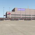
KCLT Charlotte Douglas International Airport
By fletcherj
I am excited to offer this freeware version of KCLT Charlotte Douglas International Airport created in World Editor for X-Plane 10. Charlotte Douglas is the 24th Busiest airport in the world by passenger traffic and serves as US Airways largest hub. In 2010, Charlotte was dubbed 10th busiest airport in the world by number of Aircraft Movements.
This file was created in WED 1.2 and uses the lego brick system utilized by X-Plane 10. Please download OpensceneryX for static aircraft and objects to display.
The next update will include cleaning up the airport taxi signs.
TURN ON HDR!!!
Leave me a comment!
TO INSTALL: Simply drop the KCLT Folder into your custom scenery folder and go fly!
417 downloads
Submitted
-

KYKM - Yakima Air Terminal
By sichars1968
KYKM - Yakima Air Terminal, Wa
This continues my airport scenery creations in the state of Washington, USA.
Yakima Air Terminal is situated in central Washington state, and as far as I know is served by Horizon Air Dash 8's on behalf of Alaska Airways to Seatac. There is an abundant GA presence and there is a museum portraying it's role in the past as a military airfield. There are still some charter flights transporting military personnel in and out to use nearby training ranges.
This initial upload includes all taxiways and buildings inside the airport perimeter, and some static objects. I will eventually, when time allows, add all airport signage and more object 'clutter', and hopefully ATC routes, as well as populating the empty areas to the north of the airport(unless these happen to be improved on with the introduction of 10.20+!!)
Requires OpenSceneryX and XP 10.10 beta1 or later
116 downloads
- Lego bricks
- US
- (and 1 more)
0 comments
Updated
-
KTRI Tri Cities Regional TN/VA
By nascar99
KTRI Tri Cities Regional Airport Tenesse/Virginia Servicing Bristol TN/VA, Johnson City TN, and Kingsport TN.
This scenery is only for X-Plane 10.
This scenery uses library objects and facades.
This uses the default apt.dat so I didn't tinker any ILS glide slopes or the airport layout.
Thank You to Kyle Sanders for providing charts for the Airport.
COMING NEXT IN VERSION 2.0
Possibly a detailed model of the Terminal from the Google 3D Warehouse if I can figure out how to export it from Google Sketchup to X-Plane with textures.
114 downloads
0 comments
Submitted
-
SBCT
By GusRodrigues
FS2XPlane conversion of the amazing scenery of Terra-Brasilis.
Mr Zanolli (FSX author) allowed the porting and the the upload.
OpenScenery X required!
110 downloads
0 comments
Submitted
-

KPWM Portland International Jetport
By briangodwin
This is Portland International Jetport
XP10 Only, fully G.I. and ATC compliant
Thanks to:
Jayden B for the inspiration to take this on
Baron (frede) and royaloak for the camaraderie and technical assistance
Chris and Ben at Laminar for technical assistance (and for an awesome simulator).
OpenSceneryX for the objects
2 Known issues still under investigation:
1) A section of the gate surrounding the employee parking lot will not display
2) Some trees will show up on the Fedex pad at higher tree settings even though there is an exclusion zone covering it
216 downloads
Updated
-

Biddeford Municipal - B19
By briangodwin
Biddeford Municipal Airport. This version is XP10 only. I am trying to reverse engineer my own work for a version for XP9.
A glitch has been reported about the runway heading. Although the heading for 06 (and conversely 24) is set for 55.90, in cockpit instruments display 72. I am submitting a bug report for this.
36 downloads
Submitted