

About This File
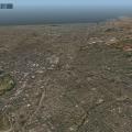
NZCH Christchurch Area Photo Scenery v1.0
March 07, 2012 - By Chris K
Copyright:
The Christchurch Area Photo Imagery is licensed under a Creative Commons Attribution 3.0 New Zealand License with Crown copyright reserved. Please read the LICENSE.RTF for further information
Scenery Credits:
- Orthophotos courtesy of Land Information New Zealand, used under license. (http://www.linz.govt.nz/topography)
Installation:
- Copy this entire directory into your "X-Plane/Custom Scenery/" folder. That's it.
- Leave the name as "_NZCH_Christchurch_Area_Photo_Scenery" so that it loads at the correct priority relative to our other NZCH packages
Complimentary Packages:
This scenery is designed to be used in concert with the following packages:
NZCH Christchurch Airport Photo Scenery
NZCH Christchurch OSM2XP Building Enhancement
Requirements:
1. Requires a Video Card with 1GB of VRAM if you want to use at 'extreme resolution'
2. Requires a Video Card with 512 Mb RAM if you want to use at 'very high'
3. Texture Compression is optional as the files are already DDS compressed.
Conflicts:
Tested in XP10, but should work with no issues in XP9 as it's only photo polys, an airport definition (NZWG), and some forest exclusion zones.
Let me know if you do find any conflicts. (Private Message Me! Don't leave them in the comments below)
Known bugs / Stuff left to do:
Still got some white edging showing up very small on some northwest tiles
- Some type of graphic artifact with the DDS conversion, even though Ive clipped the edges away. I'll investigate further.
There were some brightness differences in the original LINZ orthophotography. Easy to see from far away.
- Will try to smooth out the transitions and/or change the brightness/contrast of certain parts of the imagery for better consistency.
The Orthos are not cut to line up with roads/landmarks, so it's easy to see where X-Plane scenery ends and the ortho begins.
- will cut along a roadway line or other natural landmark in a later release, so that the transition isn't so stark.
X-Plane 10 completely missed the Waimakariri River in the underlying scenery (.DSF) generation. (The big wide river north of NZCH)
- Although I alpha the river away to show the underlying water of the river, XP10 doesn't have any water there.
Misc:
This was completely done in WED v1.1rc1 for MacOSX
© 2012 ISDG - International Scenery Development Group
Recommended Comments
There are no comments to display.
Please sign in to comment
You will be able to leave a comment after signing in
Sign In Now