Search the Community
Showing results for tags 'osm'.
-
Hiya, After adding thousands of square miles of water to OpenStreetMaps in my local region and in other areas, I'd like to do more targeted work on getting water which may be missing in X-Plane 10 into the OSM database so that when and if the scenery is re-worked, water will be there. If you know of a local lake, pond, or river of substance which is missing in the UNITED STATES in X-Plane 10, follow these steps: STEP ONE: Visit www.openstreetmap.org and LOOK to see if the water you are missing is on the map - zoom in close to be sure. If it IS there, great! No work is needed, and if the scenery is recut, the water should show up. If it is NOT there, move on to step two. (I will be very disappointed if you do not perform step one. Save us all the time and effort and make sure that the data is actually missing from the OSM map before making your request.) STEP TWO: Post a message with the city/state of the water, and the general location of the missing water (eg: 2 miles southwest of town center). I'll do my best to get it worked into OSM, but keep in mind it does depend on how many requests I get and how complex the water bodies are. I would like to avoid requests for your aunt's backyard fish pond or the stream at the end of the neighborhood street... if it's clearly visible from the air and clearly a loss to not have it in the sim, let me know! -Greg (PS : Posted to general discussion because while this work does lead to better scenery, it's not really a "scenery design" post/comment and I need as many "regular" users to see this as possible.)
-
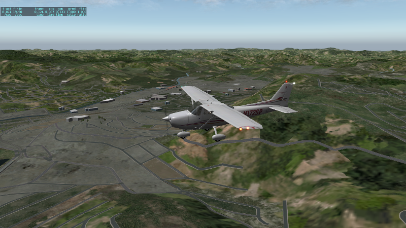
New regional scenery available for the region of Juiz de Fora, State of Minas Gerais, Brazil. It used world2xplane and is based on the latest OpenStreetMap (OSM) data for Brazil. For the best results, install also the HD Mesh Scenery v3 by alpilotx as the base scenery (lower order in the scenery.ini file). To download and know more about this scenery, go to the following page: Juiz de Fora Regional Scenery One screenshot showing the downtown of Juiz de Fora and the Paraibuna river valley.
-
- 1
-

-
- scenery
- world2xplane
-
(and 1 more)
Tagged with:
-
File Name: NA - Washington3D File Submitter: Tom Knudsen File Submitted: 22 Aug 2012 File Category: Objects X-Plane Version(s): X-Plane 10 Washington3D version 1.1 is an opensource made package gathered from OSM data provided by OpenstreetMap. NA packages include state by state rendering and are modified and assembled by the author above. Package includes 3D buildings, landclass, objects, roads and rails for whole countries. The new package is for X-Plane 10+ WHAT IS NEW Corrected facades to ensure that no "blueish" buildings are build from OSM data.This package is builded with a new redesigned facade set. Click here to download this file
-
Version 1.1
249 downloads
Washington3D version 1.1 is an opensource made package gathered from OSM data provided by OpenstreetMap. NA packages include state by state rendering and are modified and assembled by the author above. Package includes 3D buildings, landclass, objects, roads and rails for whole countries. The new package is for X-Plane 10+ WHAT IS NEW Corrected facades to ensure that no "blueish" buildings are build from OSM data.This package is builded with a new redesigned facade set.


