Jarek1983
-
Posts
2 -
Joined
-
Last visited
Jarek1983's Achievements
")


-
I have no idea I bought this module a couple of days ago and I guess I did not use nav 2 yet and it must have been 0.00 out of the box
-
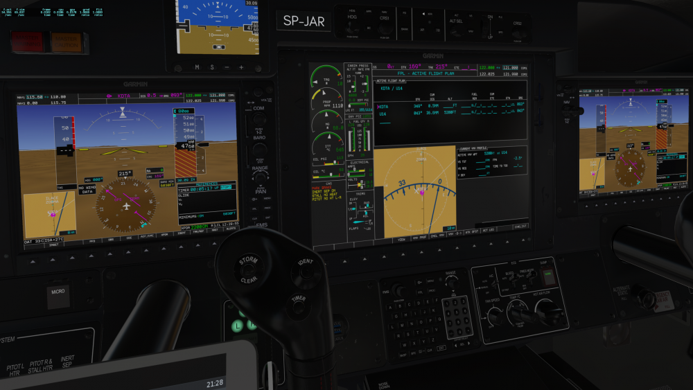
Hello! During my last flight I got wrong altitude for the destination field for FMS LTE (shown on the screeshot 355ft for UU14). My destination was U14 in Utah with field elevation of a tad over 5000ft. Something wrong with my flight plan or a database issue? Seems like a database issue, hence the wrong code for the destination aiport and the field was not visible on the synthetic vision. Thanks for your thoughts! Best, Jarek