


Lukasz
-
Posts
406 -
Joined
-
Last visited
-
Days Won
2
Content Type
Profiles
Forums
Latest X-Plane & Community News
Events
Downloads
Store
Posts posted by Lukasz
-
-
Also not enough helicopters.
-
I'd save money for Goran's Saab
 If you've done that already, go for Cessna.
 -
The price is twice too much, for the reasonable price to quality ratio. Also it looks "too generic" for me, though someone else may enjoy it. You'll never know
Not X-Plane, but that was the best Avroliner I know so far, and the first plane I couldn't start up without reading the manual:
-
That, plus which heading? Raw magnetic, calibrated magnetic or true heading?
-
If it is icing, then it's good to note, that it's X-Plane's inherent feature. Checking the weather became much more important, since I've started flying in it

-
Dzięki
 Now my poor English will also be legendary ;D So many errors...
 EDIT: Today Paul Bertorelli from Avweb.com has written a nice description of his recent ded reckon trip in a Piper Cub:
http://www.avweb.com/blogs/insider/AVWebInsider_BoringGPS_203671-1.html
-
Fuel planning
There is a discussion somewhere here about setting up Cessna Corvalis for Goodway. While it's a good idea and I like that Goodway has such capability, it's a very basic one and can cheat you pretty well under some circumstances. Good POH (or a test flight) and a little bit of thought is all you need Approach and glideslope is easy (GS*5=required descend vertical speed in fpm for a standard 3 degrees glidepath). Under VMC you'll fly visual anyway, stick & rudder. Just watch for airspeed and height/altitude above subsequent approach fixes/waypoints. Under IMC you'd better have ILS or divert to alternate with better weather. I don't believe in ded reckoning in fog on final approach. Also having some kind of airport or approach charts will be of great help.
Recommended reading on the topic of approaches, traffic patterns and landings (I couldn't write it better, so take straight from the source):
http://www.avweb.com/news/pelican/182047-1.html
http://www.avweb.com/news/leadingedge/leading_edge_23_stabilized_approaches_199047-1.html
-
Yes, of course you're free to do as you said
Spread the word and share joy of aviation!In fact anyone who wishes to do so, can repost it wherever it's desired and possible. Just include link to the source. This tutorial is a part of my cunning plan - next time, when FSX-fan says "but we have better default GPS, than you X-planers!", you could respond "so what? we don't need one anyway..." ;D
Also feel free to correct any typos or bad sentences that you find. I don't have any problems with someone correcting my spelling and grammar errors.
-
I've started my own type familiarization program already
-
Good point with monthly fly-in schedule. I was also thinking of getting ATC coverage, but for that to happen, first we should have a reasonable amount of participants. I would love to see our gatherings, as "official" Vatsim-scheduled X-Plane Fly-ins, in order to promote our simulator, but that's an idea for the future. We'll see, where that goes.
As to the theme of fly-ins, I was thinking of racing, exploring famous places and geographical landmarks, flying to rare, exotic and unknown locations, specific type of aircraft flights (f.e. warbirds fly-in), tight formation flights and others. What do you think about it? Any and all ideas are welcome!
-
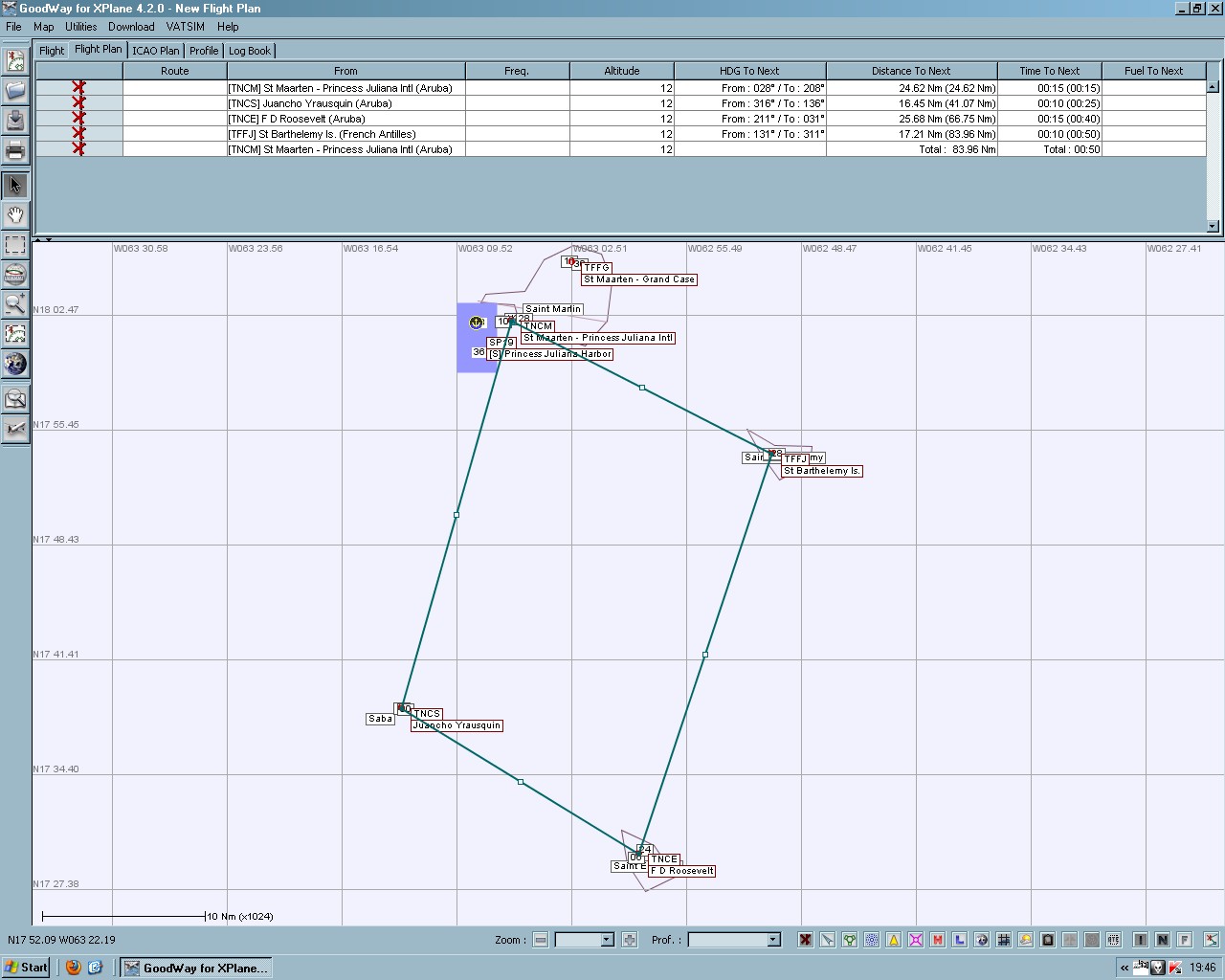
Andy has asked me to prepare the next fly-in. I've decided to change the formula a little bit and this time we'll have a race!
The rules are simple: everyone is to fly Cessna 172 Skyhawk, be it original default, the tuned performance one or a payware. There will be no prizes, because the goal is to have a good time and fun. If that idea picks up, however, we'll think of small prizes like custom repaints or else like that. Whatever the prize, the most important is a spirit of fun, friendly competition. I'll fly a "steward" aircraft along the pack to see how the things are going. The winner is the pilot who completes the whole track as the first one.
Also please, don't make your planes faster or else, don't tune them. Try to win by smart flying rather than having a whole racing stable under the hood. Each plane is to be carrying 250 lbs of payload, fuel at your discretion. We'll fly in a real weather as supplied by XSquawkbox, so you may want to log in earlier in order to check the weather and make needed arrangements.
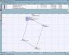
Now, the track. You can see it on the attached screenshot, along with distances and courses between waypoints. Times were calculated for 100KTAS cruise speed, but this may vary during flight. Navigation method and use of autopilot is at your discretion, but you know, what I'd like to see there
The finish line is over the eastern threshold of TNCM runway. In case of other non-race traffic being on final approach from either side, you are supposed to fly south of the runway and crossing threshold's paralell extension will be considered as crossing the finish line. All waypoints are islands and in order to "check" them, you have to fly around each island, on the "outside" side - with regards to track geometry.
According to the fly-in poll, the race will start on Saturday 30th, at 1100Z. First we'll climb and assemble in a racing line and then we'll have a Reno style airstart.
Please reply to this post in order to state your wish to participate - we'll need at least two racers.
Also there is another thing, I'd like to bring to discussion. Previous fly-ins had only from 3 to 1 pilot(s) participating. There was a poll set in order to have a fly-in at time, when the most people could join. Still, no go. That made me thinking, that maybe the fly-ins aren't neccessarily needed, maybe there is no desire at all, to have them organized. Or maybe there is another reason behind such situation. What do you think about it?
-
Polish
That's why my Vatsim plane registration starts with SP. -
Prerequisites: none
First, let me say, that there are no special skills or magic, when it comes to this type of navigation. In fact, you have all the skills already or should develop them anyway, as a part of good airmanship. This tutorial assumes that you can hold a heading within +/- 5 degrees, maintain level flight within +/- 50 feet and fly at constant airspeed within +/- 5 knots from desired values. You can use autopilot in heading and altitude hold modes, if you like, and practice your manual flying skills another time. But if you want to fly manually, then proper trimming of the plane is absolutely crucial! You really don't want the plane to do aerobatics on it's own, when you let go off controls, to make calculations or play with map. Also, I'm going to deliberately "foget" about few additional things, in order to make this tutorial as easy as possible and to keep myself on the topic. All right, are you ready to walk in the footsteps of great aviation pioneers?
When you don't reckon, you're dead
You may have seen the term "dead reckoning" and have read all kinds of jokes and more or less funny sentences based on that term. In fact, the proper name of this navigation technique is "ded" - from deductive. Like a detective, you have some clues and with their help you try to deduct your position in space, with regards to planned route. In my native language it's called "calculative navigation", because you have to use known values, like time, distance and speed, to calculate actual position in relation to takeoff or beginning of route point. Whatever the name, to overall concept is in fact silly easy.
Three amigos
You may have noticed, that airspeed is always expressed in distance per time format. Even knots are in fact nautical miles per hour. That means, if you fly for example at 100 knots, you cover 100 nautical miles in an hour. The same distance could be flown at 200 knots in 30 minutes and flying at 50 knots would require 2 hours to cover it. As you can see, there is a direct relation between three known values: airspeed, distance and time of flight. What is even more important, that you can always calculate the missing third one in a case when you have only two of them. Have you ever wondered, what to say when ATC asked for ETA to a waypoint? Or how much fuel do you need to take, knowing distance from map and your speeds and fuel consumptions from POH? Right
D-recko's Lair
Ok, time to get down to business. Take your map, choose two airfields: take-off and land. Please, let's forget for a moment about transatlantic routes
Honolulu PHNL to Molokai PHMK will be enough. My map says, that the distance between them is 47,5NM and that heading required to fly to Molokai is 92 degrees. Even if you're lazy and prefer to fly staight 'n' easy east, it won't make a difference for such short flight. Let's assume, that we're goint to fly a Cessna 172 Skyhawk, for it is very popular traning plane, with nice 100KIAS cruise speed, which makes our task a lot of easier.So, we take off from Honolulu, point the nose directly east and now what? How long do we have to fly that direction - there are other islands around, other airfields, how would we know, that we're at the right spot, when it comes to landing? In order to do that, we have to calculate flight time. I usually cheat at that point and grab my E6B flight computer (yeah, a real one) and it says 28 minutes 24 seconds. A quick memory check - at 100 knots we'll need about 30 minutes to cover about 50 nautical miles. Looks good.
But before I've finally got the E6B, I had used a regular battery powered pocket calculator, to have more accuracy with calculations, than it would be possible with my head only, already overclocked with trying not to fall out of the sky
The method to do it is as the following:Our speed is 100knots (100 nautical miles in 1 hour), which equals to:
100miles in 60 minutes
our problem is like:
47,5miles in how many minutes
so we set up a simple proportion:
100miles - 60 minutes
47,5miles - x minutes
then we cross-calculate it:
100 * x = 47,5 * 60
x= (47,5 * 60) / 100
x= (pocket calculator online...) 28,5 minutes
if you want to convert this 0,5 minute into seconds, all you have to do is to multiply it with 60:
28 minutes 30 seconds.
Now, usually you don't need that seconds, 28 minutes will do. But on longer flights, minutes become hours and seconds become minutes. And suddenly it is important to know if it is 15 minutes or 30 minutes and method to convert decimals to minutes is the same. 1,35 hour? 1 hour 21 minutes. 2,7 hours? 2 hours 42 minutes.
So, now we're flying hot racing piston, at 275knots. The race course is 10,5 nautical miles long. How long it would take to complete the track?
275miles - 60 minutes
10,5miles - x minutes
x= 2,29 minutes = 2 minutes 17,4 seconds from start to finish. Pretty hot, alright! 8)
[glow=red,2,300]And that's it[/glow] - you fly on a specific heading, at specific speed, for a specific time and every time you'll arrive at your destination no sweat, no lame GPS, no crazy NDBs & VORs
A word of caution: you really want to use X-Plane's clock. The simulation doesn't always run at exactly the same speed, as real time and the differences, that inevitably build up during a flight, can and will bite you at some point. Always use sim-time for navigational calculations!
Now you're ded reckoning apprentices and planes with just the compass, airspeed indicator and a clock suddenly become fully equipped
Let's have a short break with some of the best planes from a more civilised and elegant navigation era Say airspeed. What airspeed?
As you may know, the higher you fly, the thinner air becomes, which in turn has some important effects on plane. One of them is the higher you fly, the more the airspeed indicator is lying to you. It's because in reality it doesn't measure how fast do you fly, but how strong the airflow is beating against the Pitot tube. So, the thinner the air - the more gentle the beating and less airspeed indicated on the gauge. Hence the name - IAS or Indicated AirSpeed.
Smart folks quickly recognized that airspeed indicator is lying at altitude and they have invented another type of airspeed - a true airspeed (in opposition to liar airspeed, I guess...), whis means how fast in fact are you flying over the ground. And that is the airspeed we're going to use during navigation calculations. Now, the problem is: how do we know the true airspeed? Easy
For navigation fanatics, there is E6B... For, ekhm, normal folks, there is a simple and effective way, which is enough accurate for everyday flying and for our purposes.Read your altitude from the gauge, divide it by 1000 and multiply by 2. The number you've got is a percentage of IAS you need to add to it, in order to get TAS. So, let's just say we're doing 100KIAS at 10 000ft. That's 100KIAS + 20%. So the TAS is 120knots. If we were in a Corvalis, doing 163KIAS at 18000ft, then TAS would be 222knots. Cool, eh?
Reality check: this is not the most accurate method of estimating true airspeed, but the most easy and efficient one. Also you do want to remember, that it's accurate for a standard day, as IAS-TAS relation depends also on air temperature at altitude, because temperature affects pressure and thus the beating the Pitot gets. The colder the day, the less the IAS-TAS difference, and the hotter - the more. E6B says, that for the 100IAS-120TAS example to be true, the air temperature at 10 000ft would have to be +10C or +50F.
Tokyo Drift style
So far, all of our exercises assumed windless, calm day. However I'm yet to see that in REX or XSquawkbox weather systems ;D Winds are the most irritating part of any navigation, but they also make it so much challenging and addicting. The feeling of accomplishment after you've prevailed over the winds trying to push you off track, makes up for all the hair pulling and stick yanking you've got during the flight.
The way you're going to fight the winds depends on whether you know their direction and strenght or you don't. Since there is always plenty of weather information in X-Plane, we're going to concentrate on the known winds techniques.
As you may have quessed already, E6B can calculate winds for you and it will be even so nice that it will tell you how much degrees you have to add or subtract from your heading, in order to stay on track. However for the purpose of this tutorial, we'll do it old school pocket calculator way. Abacus with beads also will be fine, unless you fly in turbulence
Masters Of The Winds
The greatest evil the winds ca get to you, is to push you off-track. That way, even if you have maintained perfect airspeed and heading, for a precise amount of time, you will end up everywhere but your intended destination. Since you don't have the help of purple GPS line nor VOR radial needle, you will have to calculate how much influence the wind has on your plane, in order to counter it. The method I'm going to show you is again not he most accurate, but more than enough and actually easy to perform on-the-fly, so to speak.
First, for the simplicity, let's consider that the wind is blowing at 90 degrees from our intended heading. Remember that Hawaii scenario? We're flying 90 degrees and the winds are from the south, 180 degrees. In order to stay on track, we would have to point the nose to the right, but how much?
Let's assume the we're flying so low, that IAS=TAS, at 100knots and winds blows at 10knots. The formula to calculate required "counter=heading" is TAS/10/6=a; wind_speed/a=degrees to turn INTO the wind in order to maintain desired ground track.
So:
100/10/6=1,66; 10/1,66=6 - the required correction is 6 degrees, so we need to fly 98 degrees of magnetic heading in order to reach Molokai (remember, that the real heading was 92 degrees? In our previous iteration we could let go off the two, but now 2+6=8, which is almost 10 degrees - a considerable error in ded reckoning, which could become nasty even on short flights).
Another situation, we're flying the same trip, but this time at 20 000ft, 120KIAS and the winds are from the south at 38 knots.
120KIAS + 40% = 168KTAS
168/10/6=2,8; 38/2,8=13,5 - now we need to fly heading 105 (decimals of 0,5 or lower are converted to the lower full degrees, over 0,5 are converted to higher full degrees). Had the winds were form the north, we would have to fly 92-13=79 degrees of heading. Piece of cake
(unless the calculator batteries go down... Does anyone on board have E6B manual?)Let's twist again, like we did last summer
All right, before we take the final last brain twist, let's have a break:
This time DON'T even think of clicking any of the "related videos" and get back to the class asatme (as soon as the movie ends)! ;D
Now, as you may know, winds rarely want to cooperate and they tend to blow from every possible direction, mostly from the forward plane hemisphere, to kill as much of TAS as possibe. How can we defend against it? Again, E6B flight computer does all the maths, however often I just use premade chart, that is printed on my kneepad. but before I got all the goodies, the pocket calculator and a little bit of math magic did the trick.
Actually, after all these explanations, this last part of this tutorial is quite easy. Firts you need to calculate the heading correction, as if the wind was blowing perpendicularly to your plane. That's called "maximal wind correction angle" (or something like that, as I'm translating it from my crazy language. It's funny, because part of what I know is in it and part is in English, with not everything overlapping between two of them). Since the wind is blowind at some angle, only part of it's strength is used to push you off the track and the rest is used to increase or decrease TAS. But how much of the wind does what? It could be precisely calculated but for our purpose it's enough if we use the following simplified chart.
On the left you have the difference between desired heading (or ground track) and wind direction. For example, heading of 20 degrees and wind from 135 would produce a difference of 115 degrees.
On the right is how much percentage of the wind is used to push you off-track.
0 or 180 - 0 - because all the wind is used to slow you down or speed you up
30 or 150 - 50%
45 or 135 - 70%
60 or 120 - 90%
90 - 100% - it's a situation with perpendicular wind, described previously
So, our 115 degrees of difference between desired heading and wind direction means that we whould use a value of 90% as the closest one. The remaining 10% of wind speed will affect TAS and TAS with the added wind effects is called ground speed or GS. That's the speed usually displayed on your GPS. But now you don't need no satellites to know that
The chart may looks counterintuitive, because it would seem, that angle difference of 45 degrees should produce 50% wind difference, but I can guarantee, that the chart is correct.But what about the speed? Take note of the ground speed and calculate the fuel amount and fuel flow against it. It may be necessary to land earlier, if you have small reserve and strong headwinds. Don't try to add power to counter headwinds, as you'll move the engine out of economic power range, which will make fuel matter even worse. Also don't try to slow down (with tailwinds), as that will also be less effective and you may even stall the plane, especially on higher altitudes. Just fly as usual, on normal cruise power settings and take into account different times over the subseqent waypoints, than planned, as well as different overall flight time. If for example winds took away 10% of the speed from you, then recalculate time to next waypoint being 10% longer and fuel burn being 10% higher. Needed to fly a leg for 20 minutes? Then fly it for 22 and you'll arrive on spot, but a little bit later. Fly the plane and calculate where you are, not where the flightplan says you should be.
One last advise. Don't try to fly ded reckon for more than 200-300NM at a time, because over that you'll enter a world of great circle navigation and changes in magnetic variation during flight, both of which could seriously complicate your life. Either fly shorter trips, or divide whole long range flight into shorter legs, with distinctive land features along the route, like lakes, cities, rivers, mountains and so on, to help you fix actual position and correct any errors that could arise. During my long An-24 flight I had a radar that showed me the drift angle - all I had to do was to turn heading knob by the same amount of degrees. And the gyro-inductive compass has taken care of great circle and magnetic variations problems. That plane was the right tool for the job, even without GPS and that's the real secret behind the success of that flight. By the way, it was very similar to what Lindbergh did, just the details were different.
HOMEWORK!
Load X-Plane and go to Midway Atoll PMDY. Set real weather (with whatever winds you'll get along with it) and fly default L5 Stinson. In order to maximize range and endurance, fly at 2300RPM, higher than or at 6000ft and lean accordingly. IAS will be around 100mph (=87knots). You can squeeze 4 hours of flight out of it
Exercise 1
Fly to Kure Island Seaport (it has runway also). Course (=desired track) 275, distance 50NM. Then back to Midway.
Exercise 2
There is a group of small islands nearby, find them and fly back to Midway. Course 95 to the islands, distance from Midway 84NM.
Exercise 3
A classic "navigation triangle". Take off from Midway and fly for 20 minutes course 120, then 20 minutes course 240 and last 20 minutes course 360. See if you can make it back to Midway
If you like, we could do it on Vatsim next weekend, with BK117 ready for the rescue, should something unfortunate happen
Also you could post screenhots from X-Plane's location map, to show how you did with the homework Ta-Da!
Now you're the masters of ded reckoning
It's lenghty to describe (all right, half of this tutorial is actually me trying to stay on topic, instead of writing anything useful ;D ) and it seems a little bit complicated at first (try Orbiter freeware space simulator, if you hadn't had enough flying mathematics for today ) but ded reckoning in it's essence is very simple and rewarding - it's easier than mastering real Garmin 1000 (or so I've been told...). Thanks for reading and above all - enjoy your new skills See you in the airspace! -
Shots from last weekend, when I've undertaken flight from Midway PMDY to Adak (Alaska) PADK. 1452NM in An-24, ded reckoning for the most of the flight, with the help from NDBs only at the very beginning and end of the flight. The key was to use onboard radar in drift mode combined with directional gyro-inductive compass, which had to be manually set in accordance with current geographical latitude (to compensate for gyro drift and great circle navigation). And that was a couple of them, from N28 to N52. No GPS was used.
If that is not enough, I've added two additional fuel tanks (with the help from Felis. Thanks again!), as there were two versions of An-24, one of them with extended range. Also I had to download original Russian POH, with data for fuel consumption in relation to flight altitude and power set, in order to cruise as efficiently as possible, without sacrificing too much speed. To my delight, the POH also contained additional info, which made my life a lot easier and flight safer
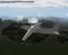
The calculations turned to be okay and I've made it to Alaska with minimal fuel reserve. Also my primitive navigation methods proved to be more accurate, than I would expect. Not only was I inside 50NM NDB receive radius, but when I've finally acquired the signal, ADF arrows pointed straight ahead 8)Four hours into flight, sunrise. Looks almost like an atmospheric re-entry:
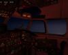
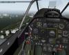
That horizontal round gauge was the most important piece of equipment on this flight. Control panel is over these colourfull flare launch buttons:
Shortly before joining traffic pattern and landing:
6 hours of flight in classic Russian turboprop - the best birthday gift I've ever got

-
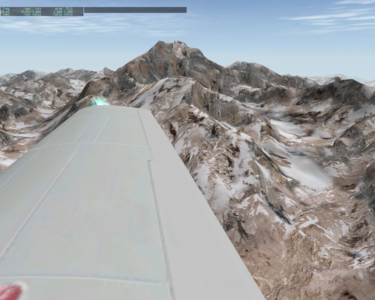
Some pics from today's fly-in. Weather was very interesting, with clear skies on the eastern (downwind) side of Andes and low, thick overcast on the other side. That's exactly the type of weather I'd expect to see with western winds, moving warm and humid air from over the ocean, around the mountains and into cold upper layers of atmosphere, as they were today and XSquawkbox weather system reflected this perfectly. REX cloud textures have further topped the experience.
The highest peak in whole Andes mountain range, the highlight of today's trip:
Three-point landing in Santiago 8) Tailwheels & taildraggers ftw!

-
Let me add, that a minimum reasonable flight level enroute is FL160 (terrain + 2000ft for mountainous area), while FL180 - FL200 would be optimal (possible mountain waves and turbulence closer to the peaks).
-
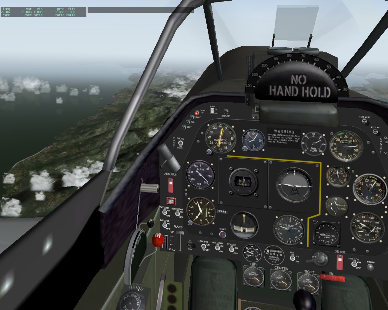
I've performed quick check and indeed there are errors in heading displays. Mentor has 4 heading displays: magnetic compass, RMI, NACWS and GPS and here is what I've found during short flight around Alaska with nose pointing directly to magnetic north pole:
- magnetic compass shows N - correct
- RMI (in real plane it's an electric directional gyro system, which is automatically corrected for gyro drift, with the help of magnetic sensor mounted on left wingtip) shows 15 - incorrect, should be N also
- NACWS in real plane takes heading from RMI and so is in our Mentor. It also shows 15 - incorrect (should be 360)
- GPS, to my best knowledge, could display whatever heading or track that user wishes, be it a combination of heading-track-magnetic-true. Our Mentor's GPS shows magnetic track combination (as indicated by another test with crosswinds). In both tests the GPS indications were correct, as it showed 360 (in second test I've corrected for winds while flying on VOR radial).
I've also taken X-Plane values and they were as following:
- magnetic & compass heading - 360 (which means I was flying straight ahead for magnetic north pole, as I meant to)
- true heading - 15 (in relation to geographical north pole - so called "true north")
- magnetic variation - -15 (minus 15, which is a difference between magnetic and true heading caused by offset between geographical and magnetic poles).
All of these values are consistent with Alaska region and real life principles of navigation.
So, the real error is only that RMI and NACWS point to geographical pole, instead of magnetic, as they should. Now, I'm not an expert in X-Plane's IT stuff, but I think this is the dataref, we're looking for RMI and NACWS:
sim/cockpit2/gauges/indicators/heading_electric_deg_mag_pilot float n degrees_magnetic Indicated magetic heading, in degrees. Source: electric gyro. Side: Pilot
Also there should be no gyro drift, as the system is constantly magnetically corrected.
By the way some good and excellent planes share this characteristics. I've almost lost a couple of long range flights, because I took corrections for magnetic variation, while it was already "corrected" by developers. Sadly, magnetic compass pointing to true north isn't something unthinkable in X-Plane world
-
;D ;D ;D


-
Screw the boat, I want that Seahawk ;D Flyable!
- Do you have some kind of system that brings down helicopter on the deck in bad weather?
- Yes, of course.
- How is it called then?
- A pilot
-
There is an additional fuel nozzle, which supplies additional amount of fuel to the engine, but only when throttle is fully open. There is a mechanical linkage that enables that. And yes, that excessive amount of fuel soaks away heat from the engine, cooling it in the process. That's why you have to run full throttle during climb, for that additional fuel makes up for less airflow around cylinders and helps keeping CHT within acceptable limits.
Throttle does nothing to the airflow cooling cylinders from outside. Only airspeed and cowling shape affects that method of cooling.
In a piston engine, there is a direct and constant gear linkage between engine shaft and propeller, be it 1:1 or other gear ratio. Therefore any RPM reduction with propeller lever also affects engine PRM. The engine still "wants" to run at the RPM set by throttle and mixture, but the propeller slows it down to the value set with propeller governor. The slower engine turns, the less power it produces.
So the throttle is set, but the engine turn slower that it should for that setting, which means that it can't suck air fast enough from behind throttle valve, to maintain appropriate "vacuum level". That enables more air moving from before throttle valve to behind throttle valve, causing increase in manifold pressure. By playing with propeller you also affect the engine itself, that's why it changes it's power setting also.
While it is possible to run "oversquare" (in fact it's good for engine, to a point), lowering prop RPM too much while maintaining high power setting can damage the engine. A good rule of thumb for GA planes is no more that 4" oversquare, but consult POH to be sure.
Lowering prop RPM has few uses. It increases propeller efficiency at higher airspeeds, it reduces engine wear, it makes less noise and vibration and indirectly it enables to fly farther. RPM may be lower, but it's the prop blade pitch that is important here. And since it's easier for a pilot to control propeller by it's speed rather that pitch, then that's why it's done like that.
"By changing cruise RPM, we are doing the same thing. A high RPM may produce the maximum power, but at a cost in drag (and fuel). Just like any airfoil, the prop has its optimum angles, too, but data on these are not readily available to the pilot, and they are often overridden by the need for the most efficient airspeeds of the airplane. But generally speaking, for any given power, the lowest possible RPM will reduce friction within the engine, and this may be the most important parameter. Some props are probably more efficient at a specific RPM." - from "Pelican's Perch" column.
EGT in reality measures quality of fuel to air ratio. Before EGT gauges, pilots adjusted mixture by observing exhaust flame colour - which indicated temperature and ratio efficiency. Bright blue flame was an indication of a perfect ratio, as a peak on EGT gauge is today. In reality air doesn't ideally mix with fuel, so you have to introduce a little bit of extra fuel, hence the maximum power is achieved around 50-80F ROP, and not at the peak itself. By the way, you need to adjust mixture and EGT after each altitude and power change, as the peak moves up and down, reflecting the influence of the rest of variables.
Yes, you need rich mixture and full throttle to have as much as possible fuel to soak the heat. However too much mixture leads to loss of power or even carburetor flooding. So rich mixture doesn't always mean the red lever fully forward. Rich - lean is subjective and is judged by EGT for given conditions.
-
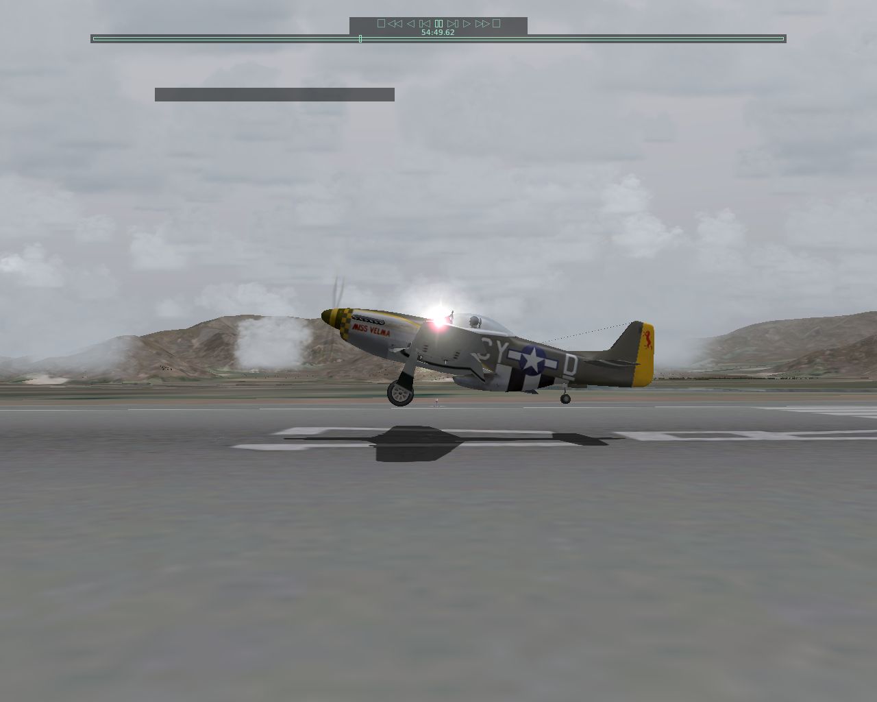
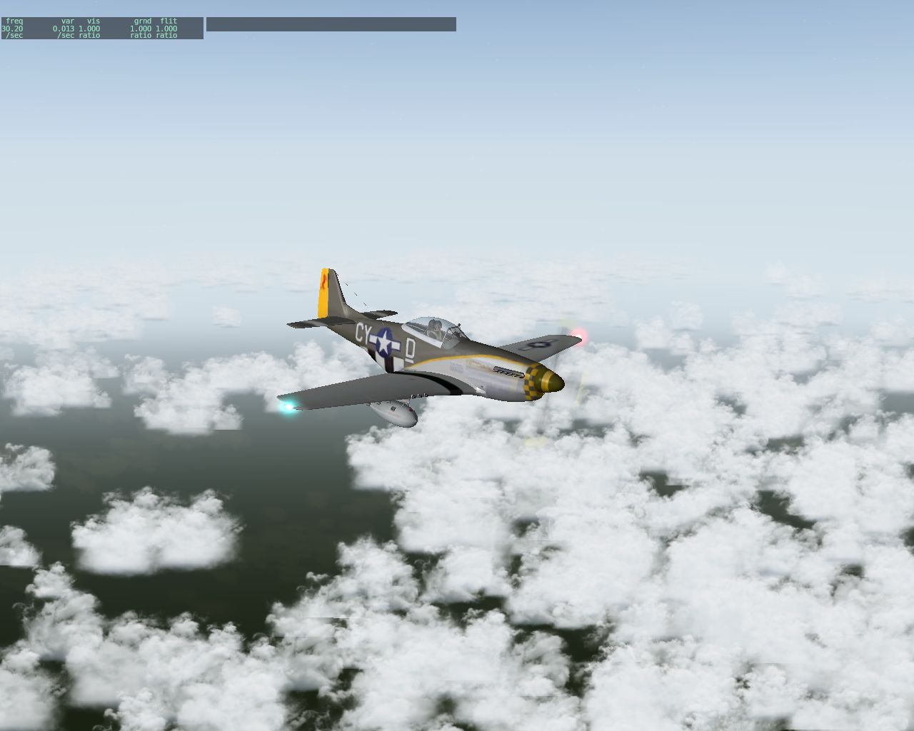
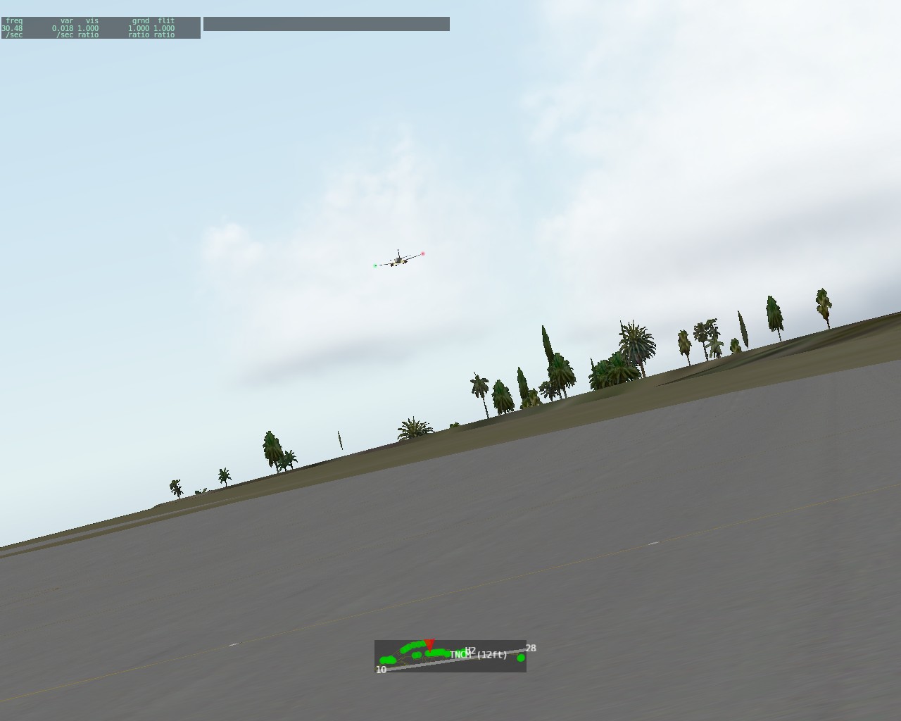
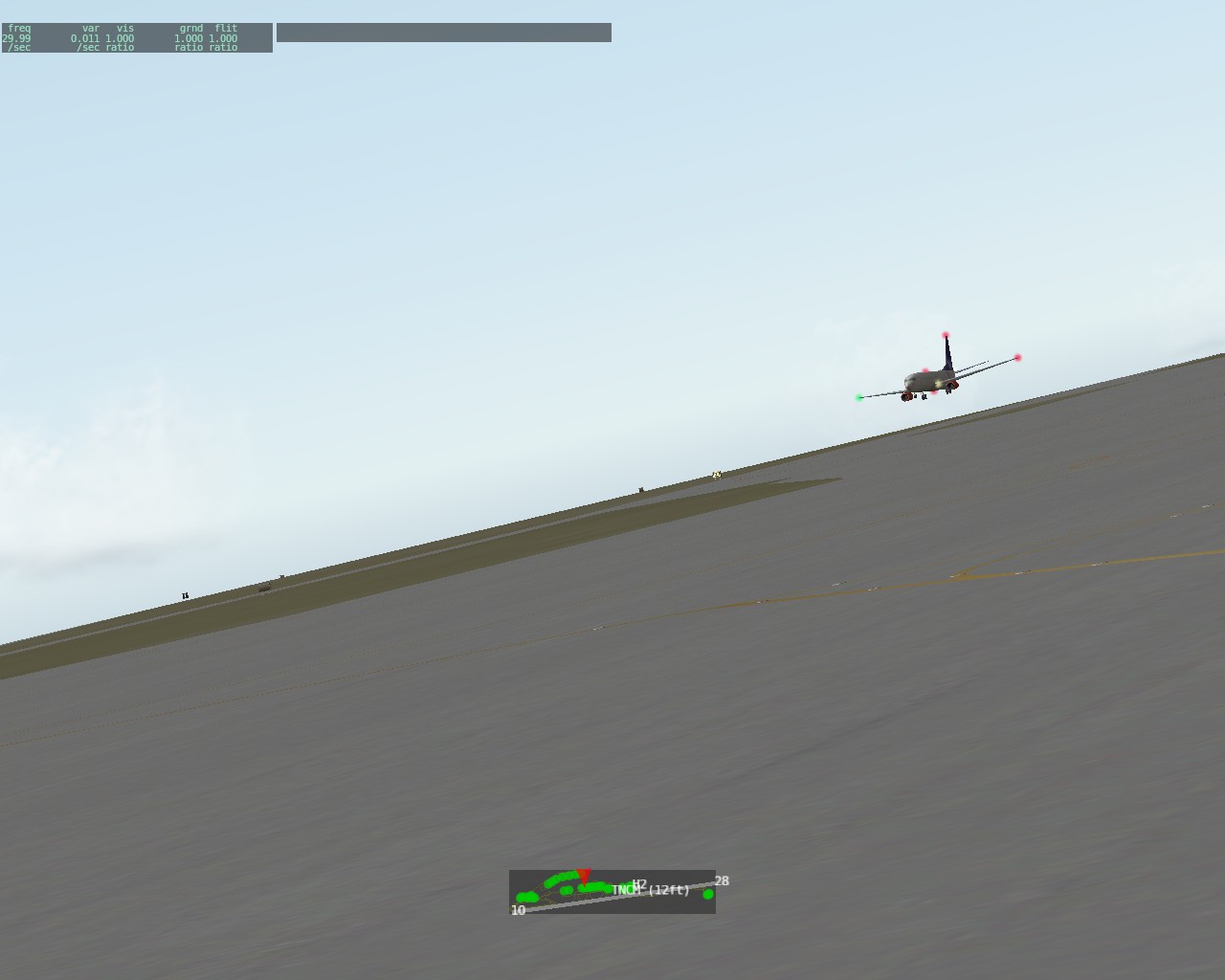
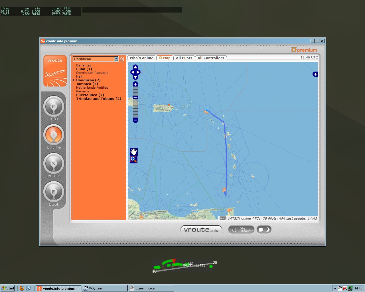
As I said before, I took "Miss Velma" for a ride across Carribean.
Andy took off well before me, but due to some technical difficulties, he had to land midway, which enabled me to overtake him, around Antigua.
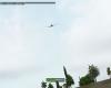
I've landed and taxiied to the ramp in St. Maarten just in time to capture his landing.
While he was in the pattern and momentary flew out of visual range, I've checked my ground track. Not bad for a fully manual ded reckon flight, with winds at FL250

-
Out of my current fleet, only the P-51 has the (more or less) required performance, with 371-375 KTAS at 25000ft
It will be an interesting flight. -
More An-24 madness
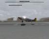
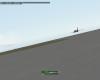
Stinson approaching Midway.

-
Yes, we do fly-ins on Vatsim. Just show up on the appropriate airfield, at the appropriate time and we'll be happy to fly with you


Insane skill
in Videos
Posted