
DSF Scenery Packages
145 files
-

YTYA - Tyabb Airport, Australia
YTYA - Tyabb Airfield - Melbourne Australia - By X-Plane Australia
For X-Plane 10.10b3
Special thanks to the following people for allowing me to use their custom objects:
Landrover From Pixelmaster: http://forums.x-plane.org/index.php?app=downloads&showfile=9798
Wind Vane From walterblenny: http://forums.x-plane.org/index.php?app=downloads&showfile=15848
Submarine From Hypersonic Test Pilot: http://forums.x-plane.org/index.php?app=downloads&showfile=16572
Waving Flag From Chris Noe: http://forums.x-plane.org/index.php?
app=downloads&showfile=17090
The following scenery libraries are needed for this scenery to work properly:
Opensceneryx- http://www.opensceneryx.com/
R2 Objects Library- http://xplane.cz/en/2011/04/01/r2-library-knihovna-3d-objektu/
Ruscenery Library- http://www.x-plane.su/projects/ruscenery.html
Also Special thanks to Chris K for showing me how to create the photo scenery ground textures.
The 7cm/pixel ground textures have been obtained from Nearmap. Their community license has been included in the package.
License: You are not allowed to modify or redistribute this file without my permission (contact X-Plane Australia on x-plane.org).
If you would like to use some of my custom objects for your own scenery file you must contact me first.
Installation:
1. Make sure you already have the OpensceneryX, R2, and Ruscenery object librarys installed.
2. Move the file "YTYA - Tyabb Airport" into your custom scenery folder.
Note: For the best effect you are going to want to run this scenery at a texture resolution of Very High or Extreme. This scenery might be too much for some older computers.
Thanks and Enjoy
Andy
227 downloads
0 comments
Submitted
-

YTYA - Tyabb Airport
Tyabb Airfield V2 - YTYA - Australia!
By X-Plane Australia
Made for X-Plane 10.25r1 (64 bit)
April 2014
The following scenery libraries are needed for this scenery to work properly:
Opensceneryx- http://www.opensceneryx.com/
R2 Objects Library- http://xplane.cz/en/...vna-3d-objektu/
Ruscenery Library- http://www.x-plane.s.../ruscenery.html
Installation:
Make sure you already have the OpensceneryX, R2, and Ruscenery object libraries installed.
Move the file "Tyabb Airport V2" into your custom scenery folder.
If you do not have all the above scenery libraries installed it may cause X-Plane to crash on startup.
Thanks for the help:
Chris K from ISDG for showing me how to create photo scenery ground textures from Nearmap images.
Simon W from the XsimReviews blog for his Sketchup to X-Plane tutorials.
The following objects have been included with permission from their respective authors:
Grass facades from ISDG with permission from Chris K: http://isdg.com.au/
Land rover from Pixelmaster: http://forums.x-plane.org/index.php?app=downloads&showfile=9798
Submarine from Hypersonic Test Pilot: http://forums.x-plane.org/index.php? app=downloads&showfile=1657
Waving Flag from Chris Noe: http://forums.x-plane.org/index.php?app=downloads&showfile=17090
The 7cm/pixel ground textures have been obtained from Nearmap. Their
community license has been included in the package.
License:
You are not allowed to modify or redistribute this file without my
permission (contact X-Plane Australia on X-Pilot)."
If you would like to use some of my custom objects for your own scenery
file you must contact me first.
Incompatibility:
Sadly this scenery is not compatible with Barry Robert’s ‘Aussie Packs
7’ as it includes a version of Tyabb that gets in the way. The rest of
Aussie Packs as well as VOZ will however work perfectly with this
scenery.
Runways Follow Contours MUST be turned on at Tyabb!
Otherwise you will sink through the runway…
For a better overall experience:
Runway "goodgrass" alternative by xflyer: http://forums.x-plane.org/index.php?app=downloads&showfile=17126"
Ashphalt Runways Enhanced by FlyJSim: http://forums.x-plane.org/index.php?app=downloads&showfile=16270"
Real Terra Haze for Fly With Lua: http://forums.x-plane.org/index.php?app=downloads&showfile=22387
This scenery is the end result of hundreds of hours of development. I can only hope you enjoy this scenery as much as I enjoyed making it!
Have a nice day
Andy
(X-Plane Australia)
P.S. If you ever find yourself in a hanger with a closed door, try turning on your aircraft's battery switch. DataRefs are great!
113 downloads
0 comments
Updated
-

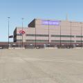
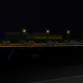
YSSY Sydney Kingsford Smith Intl (ISDG)
By chris k
YSSY Sydney Kingsford Smith Intl (XP10)
Sydney, Australia - v1.41
Aug 10, 2014
WARNING: Use at Your own Risk. We assume no responsibility for blown up power supplies or melting GPUs.
Requirements:
- X-Plane 10.20 (http://www.x-plane.com/)
- OpensceneryX 2.0 (http://opensceneryx.com/)
- Texture Compression ENABLED (else you'll blow X-Plane's 3.5Gb RAM Limit)
This scenery runs around 860 Mb loaded at "extreme" resolution compressed w/X-Plane 10 Loaded.
Uncompressed, and you're into 1.4-1.5 Gb, meaning you're dangerously close to crashing XP10_32bit
- A Modern Video Card with MINIMUM 512Mb VRAM.
This scenery fully runs at or around 512Mb of VRAM when loaded in XP10 with "very high".
I highly suggest this setting for now until XP10_x64
- You will want to run this scenery at "very high" or "extreme" Texture Resolution, or else the effect is lost.
Sorry to the users with 256Mb VRAM or less. This just isn't going to work out for you.
Time to think of upgrading, since XP10 uses almost 300Mb all by itself, with nothing loaded.
__________________________________________________________
SHUT DOWN EVERYTHING ELSE ON YOUR COMPUTER if you have a 512 Mb Video Card!
You will need every ounce of VRAM in your card for this scenery!
Kill any Web Browsers, Desktop Wall Paper, and anything that couple possibly use Video RAM.!
- If you get some texture swap, look around a little bit at the beginning in all directions, and let it settle.
- Go to External views as well, zoom far out and back in, X-Plane will start swapping out unused textures.
- Go to rendering options, toggle between full-screen to windowed and back. For some reason, this also works for me to optimise the VRAM.
__________________________________________________________
Credits:
Many people have generously donated their time, skills, and objects. This could not have been done without them.
- Ropeless (Many Many Many Many Photoshopped Tiles, Concrete Gables from YSCN - Thanks to the Doctor!)
- Fenriz (Many Many Photoshopped Tiles)
- SimmoW (Photoshopped Tiles)
- GaryBKK (Various Shipping Containers, Container Crane)
- Sethesus (Checkered Huts, Electrical Junction Boxes, YSSY Tower, Signage, Clutter)
- HenryT (Checkered Huts, Clutter)
- Nickster (Radio Mast, Radar Ball, Red shipping containers, dumpsters, diggers, bollards, Clutter)
- Skyflyer (HungryJacks, Billboards, McDonalds, Signage, Clutter)
- Laminar for the LOWI XP9 Buildings.
- Nerarmap.com for the Orthophotography Imagery at 15cm resolution (free redistribution and derivation for noncommercial use)
__________________________________________________________
Additional Files/Enhancements:
I highly suggest using Jack's (FlyJSim's) "über-kewl" Asphalt replacement textures found here for proper runway effect:
Hi-Res Replacement Asphalt Textures
I also suggest the Vehicle Library Extension found here, and crank up the 'Number of Cars". Looks great!
Vehicle Library Extension
__________________________________________________________
Bugs/Todo:
Still some stuff to do - I'm aware of them i.e:
- Some Gate Markings/Centrelines aren't finished yet.
- Certain Buildings are simply "stand ins" until we better XP10/OSX objects
i.e. "Delta Hangar" should be Qantas Hangar, and "USPS Post Office" should be Australia POST.
__________________________________________________________
License:
This scenery is Dorito-ware. Meaning that if you like it, you are obligated to send us a bag of Cool Ranch Doritos.
The Australians have never heard of this flavour, and it's impossible to purchase it here in Sydney.
__________________________________________________________
Author's Notes:
This Scenery took 5 Months of planning, editing, assembling, and a complete Team of like-minded dedicated people.
I was very fortunate to have met and worked with an awesome and talented group of individuals on this project.
My hats off to Ropeless, who was by far the most dedicated individual and "photoshopping-machine" on this project. =)
Without his tireless work and encouragement, this project would have never gotten off the ground.
This scenery is dedicated to the entire X-Plane Community. You know who you are =)
© 2012-2014 chris k
__________________________________________________________
P.S. You like Photoscenery?
Try this one: NZCH Christchurch Airport Photo Scenery (XP10)
Or this one: YSCN Camden Airport Photo Scenery (XP10)
2,128 downloads
Updated
-

YPPF Parafield Airport and Adelaide City Photoreal
By chris k
YPPF Parafield Airport and Adelaide City Photoreal
Version 1.1 Update
Mar 09, 2013
The International Scenery Development Group (ISDG)
__________________________________________________________
1.1 Update:
- Made city replacement terrain files "less green" by tightening the shrub overlay textures.
- Added night _LIT textures to the city; hence nighttime flying now looks like XP9 rather than completely dark.
- Fixed an over-sized DDS Texture - This scenery now loads in XP9 via the Compatibility Library.
XP9 Users, you can download : http://forums.x-pilot.com/index.php/files/file/327-x-plane-10-compatibility-library-for-x-plane-9/
__________________________________________________________
Requirements:
- X-Plane 10.20 or better
- OpensceneryX 2.0 (http://opensceneryx.com/)
- A Modern Video Card with minimum 512 Mb VRAM, 1 Gb is highly recommended
- Ability to run at "Very High" texture resolutions (with compression enabled), else the effect is lost.
- X-Plane 64-bit and a 2 Gb VRAM Video card is recommended for the Highest Texture resolutions.
(No... We're not kidding... we will use every ounce of VRAM you have!)
__________________________________________________________
Installation:
Unzip and place folder "YPPF Parafield Airport and Adelaide City Photoreal" in your X-Plane/Custom Scenery/ folder.
- If VOZ is installed, then "YPPF Parafield Airport and Adelaide City Photoreal" must come before VOZ in the "scenery_packs.ini" file.
- If you are installing this for the first time, this scenery will automatically be placed first (which is correct, and will work immediately)
Uninstall:
Delete the "YPPF Parafield Airport and Adelaide City Photoreal" directory from your X-Plane/Custom Scenery/ folder.
__________________________________________________________
Custom Features of this Scenery Package:
- Photorealistic terrain at 15cm/pix resolution
- Hi-Res Australian-Style Urban Texture Replacements
- Complete Customized Adelaide City Downtown (CBD) buildings and parks
- Current Airport Taxiways, Tarmac, Markings, and Signage
- Custom 3D Control Towers and Field Support buildings
- X-Plane 10 Compliant ATC/AI Taxi Flow System
- Airport grounds modelled via XP10 Library and Customized 3D Objects
- HDR Lighting Support with Custom HDR Lights
- Windsocks - Australian Style coloured windsocks, with HDR lighting
- Regional Hangars and Localized Signage
- Field Obstacles, Gables, and Bollards
- Forests, Trees, Vegetation, and Grass
- Advertising and Billboard Signage
- Full Downtown Adelaide (CBD) Buildings
- "Gritty" Texture Support
- Lumber and 6 Restaurants just a short drive away
- This time there's a map of the grounds included.... see if you can find it!
__________________________________________________________
Credits:
Project Lead : Ropeless
Lead 3D Modeller : Sethesus
Misc 3D Models : Ropeless, Skyflyer, AndrooC, Chris K
Placements : Ropelss, Skyflyer, Chris K
Taxiways : Ropeless
Taxi Signage : Ropeless, Chris K
Tarmac Stencilling : Skyflyer
Vegetation : Ropeless, Chris K
City Textures : Chris K
City Skyline : Skyflyer, Ropeless
HDR Lighting : Ropeless, Chris K
Moral Support : Everyone else!
__________________________________________________________
Hang on, Who are these crazy scenery guys?
Ropeless - Orthophoto Guru, WED & ATC Taxi Flow Master, HDR Lighting Overlord, and Photoshopping Machine.
SkyFlyer - Photoshopping, 3D Signage and Modelling, Stenciller, and our Local "Man on the Ground" again!
Sethesus - Lead 3D Modeller, Textures, and spits out Incredible objects faster than we can ask for them.
Karingka - 3D Modeller, WED Manipulator, Textures, FS-Conversions, Encouragement.
AndrooC - 3D Modeller, Textures, Sketchup Object Weaver, johnny-on-the-spot.
Chris K - WED Addict, Taxiway Paver, Object Rotator, Scenery Assembler, X-Grinder, Gardener.
__________________________________________________________
Derived Object and Scenery Credits:
- Barry (Baz) Roberts: Original VOZ/AussiePak Objects - Retrofitted for XP10, re-textured, and HDR Enabled
- Nearmap.com: Orthophotos under Free Derivative Creative Commons License (CC-SA)
- Hypersonic Test Pilot: Guardrail objects and facades, used with permission.
- Nickster: Radio Masts/Towers. Free derivation of any objects for use in scenery as per his note.
See ISDGLibrary/objects/towers/radio/License - Original Author.txt
If we have forgotten anyone for objects not credited, please contact for inclusion or removal.
ISDGLibrary/Forests/tree_textures:
Copyrights are owned by Andras Fabian, Albert Laubi, and Laminar Research. They
are used unmodified with permission of Andras Fabian.
See ISDGLibrary/Forests/tree_textures/README.txt
ISDGLibrary/Objects/windsocks:
Thecustom windsocks are modified X-Plane resources with copyrights owned
by Laminar Research. These objects cannot be sold or used with any
flight simulator apart from X-Plane.
See ISDGLibrary/Objects/windsocks/README.txt
ISDGLibrary/Forests/grass:
Contains material produced by "Simon W.".
Used under the license implied in:
ISDGLibrary/Forests/grass/How to grow grass.pdf
ISDGLibrary/Objects/vehicles:
Car and truck objects sourced from "Vehicle Library Extension"
Used with permission from Jeff M. (Joyfulsongsters) and Cami de Bellis.
See ISDGLibrary/Objects/vehicles/README.txt
__________________________________________________________
Synergies
This scenery is designed to work best with:
YPAD Adelaide Airport Photoreal - http://forums.x-pilot.com/index.php/files/file/432-ypad-adelaide-airport-photoreal-xp10/
Glenelg South Australia Photoreal - http://forums.x-pilot.com/index.php/files/file/345-glenelg-south-australia-near-ypad/
Vehicle Library Extension - http://forums.x-pilot.com/index.php/files/file/125-additional-vehicle-library-extension-xp9xp10-isdg/
FlyJSim Asphalt Textures - http://forums.x-plane.org/index.php?app=downloads&showfile=16270
Wide Taxiway Marking Replacements - http://forums.x-pilot.com/index.php/files/file/406-wide-taxiway-markings-library-replacement/
SkyMAXX sky colouring using "Vivid Skies" - http://forums.x-plane.org/index.php?app=downloads&showfile=15821
BeachMAXX Ocean Textures - http://forums.x-plane.org/index.php?app=downloads&showfile=17311
__________________________________________________________
Reference Materials
Visual Pilot Guide for Parafield can be found on the CASA website:
http://casa.gov.au/wcmswr/_assets/main/pilots/download/parafield.pdf
ERSA entry for the airport at:
http://www.airservicesaustralia.com/aip/current/ersa/FAC_YPPF_15-Nov-2012.pdf
IFR Charts for the airport at:
http://www.airservicesaustralia.com/aip/current/dap/AeroProcChartsTOC.htm#P
Google maps for the area at:
http://maps.google.com.au/maps?ll=-34.793788,138.632526&spn=0.042291,0.055017&z=14
Wikipedia entry for the airport is at:
http://en.wikipedia.org/wiki/Parafield_Airport
__________________________________________________________
Legal:
Scenery and 3D Object work copyright © 2012-2013 by the ISDG (International Scenery Development Group)
All other derived materials are Copyright their respective rights holders, used with permission.
You do not have to pay for this scenery. This scenery is Postcard-Ware.
Please send us a postcard if you like the work! We'd love to hear from you.
ISDG Group
PO Box 892
North Sydney, NSW 2059
Australia
....We still haven't received a single postcard for YPAD.... C'mon guys..!
__________________________________________________________
Contact us @ x-plane.org
chris k
ropeless
skyflyer
sethesus
karingka
androoc
__________________________________________________________
Other ISDG Group Member Sceneries:
YSSY Sydney Australia - http://forums.x-pilot.com/index.php/files/file/78-yssy-sydney-australia-airport-photo-scenery-xp10/
YPAD Adelaide Australia - http://forums.x-pilot.com/index.php/files/file/432-ypad-adelaide-airport-photoreal-xp10/
YSCN Camden Australia - http://forums.x-plane.org/index.php?app=downloads&showfile=14867
NZCH Christchurch NZ - http://forums.x-pilot.com/index.php/files/file/122-nzch-christchurch-airport-photo-scenery-xp10-isdg/
KPDX Portland OR USA - http://forums.x-plane.org/index.php?app=downloads&showfile=11248
KRMN Stafford VA USA - http://forums.x-plane.org/index.php?app=downloads&showfile=15638
KSEA Seattle WA USA - http://forums.x-pilot.com/index.php/files/file/321-ksea-seattle-photoreal-underlay/
KBOS Boston MA USA - http://forums.x-plane.org/index.php?app=downloads&showfile=15851
CYTZ Toronto Island ON - http://forums.x-pilot.com/index.php/files/file/301-cytz-toronto-island-airport-and-downtown-toronto-xp10/
__________________________________________________________
Hope you Enjoy!
- The ISDG Team
481 downloads
Submitted
-

YPAD Adelaide Airport Photoreal (XP10)
By chris k
YPAD Adelaide Airport Photoreal Scenery (XP10)
Version 1.3 Release
Mar 03, 2013
__________________________________________________________
Features:
Photo-realistic terrain at 15cm/pix resolution
Accurately modeled Taxiways, Tarmac, Markings, and Signage
Accurately modeled Control Towers and Field Support buildings
Complete X-Plane 10 Compliant ATC/AI Taxi Flow System
Accurately Modeled Airport grounds and 3D Object placement
Customized HDR Lighting w/accurate light-stand models and positions
Customized HDR Lit Windsocks for landing visibility
Customized Terminal Entrance and Passenger drop-off zone Signage
Customized Gate Number Lighting
Customized Hangars and Localized Signage
Customized Runway Hold-Short Lighting
Animated Jetways and Autogate DGS System (xp10_32bit only for now)
Animated Terminal Doppler Radar
Animated Service Vehicles
Accurate Field Obstacles, Gables, and Bollards
Custom Forests, Trees, Vegetation, Grass, and Reeds
Customized (Non-Autogen) Terminal Roadway Lighting
Current Advertising and Billboard Signage
Downtown Adelaide (CBD) Buildings
Custom vehicles, parking lots, and associated vehicle HDR lighting
Accurate Helipads, Lighting, Markings, and Training Areas
Full "Gritty" Texture Support
And most important... 4 Different Restaurants to Choose From! (See if you can find them all)
_________________________________________________________
New in 1.2:
Removed artifact on orthophoto (Tile 12-6 near terminal gate).
Refactored ISDGLibrary
__________________________________________________________
New in 1.3:
New taxiway and runway edge grass; Gives a nice soft touch to the scenery.
Replaced Windsocks with Australian Style Windsocks w/HDR Lighting.
Added new Long Grass and Reed Areas via Facades; Little-to-no FPS Impact.
Added Yellow Warning lighting in key ares (Incursion Hotspots as per AIP)
Added guidance markers for main tarmac/ramp entrance/exit areas
Updated ISDG Library
Updated Autogate 1.40 (with LIT night textures)
__________________________________________________________
Scenery and 3D Object work:
Copyright © 2012-2013 by the ISDG (International Scenery Development Group)
All other derived materials are Copyright their respective rights holders, used with permission.
__________________________________________________________
Who Are We:
Ropeless - Orthophoto Guru, ATC Taxi Flow Master, HDR Lighting Overlord, and Photoshopping Machine.
SkyFlyer - Photoshopping, 3D Signage and Modelling, Stenciller, and our Local "Man on the Ground" who owns a nice camera.
Sethesus - 3D Modeller, Animations, and Johnny-on-the-spot for most of the custom objects you see.
Chris K - WED Addict, Taxiway paver, Object Rotator, Scenery Assembler, Gardener.
__________________________________________________________
Derived Object and Scenery Credits:
- Barry (Baz) Roberts: Original AussiePak1 Objects fixed for XP10 and re-textured
- GaryBKK (Gary): Containers and Ships
- Walterblenny (Al): AWSS Tower
- Nearmap.com: Orthophotos under Free Derivative Creative Commons Licence
ISDGLibrary/Forests/tree_textures:
Copyrights are owned by Andras Fabian, Albert Laubi, and Laminar Research. They are used unmodified with permission of Andras Fabian.
See ISDGLibrary/Forests/tree_textures/README.txt
ISDGLibrary/Forests/grass:
Contains material produced by "Simon W.".
Used under the licence implied in:
ISDGLibrary/Forests/grass/How to grow grass.pdf
ISDGLibrary/Objects/vehicles:
Car and truck objects sourced from "Vehicle Library Extension" http://forums.x-plan...showfile=16812.
Also in "New auto traffic" http://forums.x-plan...showfile=15244.
Used with permission from Jeff M. (Joyfulsongsters) and Cami de Bellis.
See ISDGLibrary/Objects/vehicles/README.txt
__________________________________________________________
Requirements:
- X-Plane 10.20 or better (http://wiki.x-plane.com/beta)
We know the art library in the 10.20 beta runs may change, if it does, we'll issue a fix.
- OpensceneryX 2.0 (http://opensceneryx.com/)
- A Modern Video Card with MINIMUM 512Mb VRAM.
This scenery (Plus X-Plane 10) use ~500 Mb of VRAM when loaded at "very high" with compression enabled.
- You will want to run this scenery at "very high" or "extreme" Texture Resolution.
- X-Plane 10.20 64-bit and 1 Gb VRAM Video card is recommended for the Higher Texture resolutions.
- Charts for YPAD: http://www.airservic...com/aip/aip.asp
__________________________________________________________
This scenery is designed to work best with:
Vehicle Library Extension (http://forums.x-pilo...n-xp9xp10-isdg/)
FlyJSim Asphalt Textures (http://forums.x-plan...&showfile=16270)
SkyMAXX sky colouring using "Vivid Skies" (http://forums.x-plan...&showfile=15821)
BeachMAXX Ocean Textures (http://forums.x-plan...&showfile=17311)
Autogate DGS System (http://forums.x-plan...s&showfile=5038)
Wide Taxiway Line Markings (http://forums.x-pilot.com/index.php/files/file/406-wide-taxiway-markings-library-replacement/)
__________________________________________________________
Still to fix:
- Some buildings are still a little too "glow in the dark" at night.
These are converts from AussiePak1 which were toned down, but could use some better lighting.
- Lost the edge grass facade functionality in the 10.20 betas. Bug report submitted.
__________________________________________________________
License:
This scenery is Postcard-Ware. Send us a postcard if you like the work! We'd love to hear from you.
See the included README.RTF for our address.
__________________________________________________________
Contact us @ X-Pilot.com:
chris k
ropeless
skyflyer
sethesus
karingka
__________________________________________________________
Other ISDG Group Member's Sceneries:
YSSY Sydney Australia - http://forums.x-pilot.com/index.php/files/file/78-yssy-sydney-australia-airport-photo-scenery-xp10/
YSCN Camden Australia - http://forums.x-plan...&showfile=14867
NZCH Christchurch NZ - http://forums.x-pilot.com/index.php/files/file/122-nzch-christchurch-airport-photo-scenery-xp10-isdg/
KPDX Portland OR USA - http://forums.x-plan...&showfile=11248
KRMN Stafford VA USA - http://forums.x-plan...&showfile=15638
Glenelg, South Australia - http://forums.x-pilot.com/index.php/files/file/345-glenelg-south-australia-near-ypad-xp10/
KSEA Seattle WA, USA - http://forums.x-pilot.com/index.php/files/file/321-ksea-seattle-photoreal-underlay/
KBOS Boston, MA, USA - http://forums.x-plan...&showfile=15851
__________________________________________________________
Copyright © 2012-2013 by the ISDG (International Scenery Development Group)
828 downloads
Updated
-

YPAD Adelaide Airport Photoreal (XP10)
By chris k
YPAD Adelaide Australia Airport Photoreal (XP10)
Version 1.31 Release
Mar 04, 2013
__________________________________________________________
Features:
Photorealistic terrain at 15cm/pix resolution
Accurately modelled Taxiways, Tarmac, Markings, and Signage
Accurately modelled Control Towers and Field Support buildings
Complete X-Plane 10 Compliant ATC/AI Taxi Flow System
Accurately Modelled Airport grounds and 3D Object placement
Customized HDR Lighting w/accurate light-stand models and positions
Customized HDR Lit Windsocks for landing visibility
Customized Terminal Entrance and Passenger drop-off zone Signage
Customized Gate Number Lighting
Customized Hangars and Localised Signage
Customized Runway Hold-Short Lighting
Animated Jetways and Autogate DGS System
Animated Terminal Doppler Radar
Animated Service Vehicles
Accurate Field Obstacles, Gables, and Bollards
Custom Forests, Trees, Vegetation, Grass, and Reeds
Customized (Non-Autogen) Terminal Roadway Lighting
Current Advertising and Billboard Signage
Custom vehicles, parking lots, and associated vehicle HDR lighting
Accurate Helipads, Lighting, Markings, and Training Areas
Full "Gritty" Texture Support
....And most important... 4 Different Restaurants to Choose From! (See if you can find them all)
__________________________________________________________
New in 1.1:
Added Marginal's Amazing New Animated Glass Jetways (Autogate).
Get The Plugin here: http://forums.x-plane.org/index.php?app=downloads&showfile=5038
Now with full x86_64 bit support
Removed AWSS Tower and Field Grass due to FPS Issues with some users
Added Some additional Exclusion zones on RWY 05 Approach
Removed CBD Buildings (to make way for another ISDG scenery package which includes a much better CBD; coming soon...)
__________________________________________________________
New in 1.2:
Removed artifact on orthophoto (Tile 12-6 near terminal gate).
Refactored ISDGLibrary
__________________________________________________________
New in 1.31:
New taxiway and runway edge grass; Gives a nice soft touch to the scenery.
Replaced Windsocks with Australian Style Windsocks w/HDR Lighting.
Added new Long Grass and Reed Areas via Facades; Little-to-no FPS Impact.
Added Yellow Warning lighting in key ares (Incursion Hotspots as per AIP)
Added guidance markers for main tarmac/ramp entrance/exit areas
Updated ISDG Library
Updated Autogate 1.40 (with LIT night textures)
__________________________________________________________
Scenery and 3D Object work:
Copyright © 2012-2013 by the ISDG (International Scenery Development Group)
All other derived materials are Copyright their respective rights holders, used with permission.
__________________________________________________________
Who Are We:
Ropeless - Orthophoto Guru, ATC Taxi Flow Master, HDR Lighting Overlord, and Photoshopping Machine.
SkyFlyer - Photoshopping, 3D Signage and Modelling, Stenciller, and our Local "Man on the Ground" who owns a nice camera.
Sethesus - 3D Modeller, Animations, and Johnny-on-the-spot for most of the custom objects you see.
Chris K - WED Addict, Taxiway paver, Object Rotator, Scenery Assembler, Gardener.
__________________________________________________________
Derived Object and Scenery Credits:
- Barry (Baz) Roberts: Original AussiePak1 Objects fixed for XP10 and re-textured
- GaryBKK (Gary): Containers and Ships
- Nearmap.com: Orthophotos under Free Derivative Creative Commons Licence
ISDGLibrary/Forests/tree_textures:
Copyrights are owned by Andras Fabian, Albert Laubi, and Laminar Research. They are used unmodified with permission of Andras Fabian.
See ISDGLibrary/Forests/tree_textures/README.txt
ISDGLibrary/Forests/grass:
Contains material produced by "Simon W.".
Used under the licence implied in:
ISDGLibrary/Forests/grass/How to grow grass.pdf
ISDGLibrary/Objects/vehicles:
Car and truck objects sourced from "Vehicle Library Extension" http://forums.x-plane.org/index.php?app=downloads&showfile=16812.
Also in "New auto traffic" http://forums.x-plane.org/index.php?app=downloads&showfile=15244.
Used with permission from Jeff M. (Joyfulsongsters) and Cami de Bellis.
See ISDGLibrary/Objects/vehicles/README.txt
__________________________________________________________
Requirements:
- X-Plane 10.20 or better
We know the art library in the 10.20 beta runs may change, if it does, we'll issue a fix.
- OpensceneryX 2.0 (http://opensceneryx.com/)
- A Modern Video Card with MINIMUM 512Mb VRAM.
This scenery (Plus X-Plane 10) use ~500 Mb of VRAM when loaded at "very high" with compression enabled.
- You will want to run this scenery at "very high" or "extreme" Texture Resolution.
- X-Plane 10.20 64-bit and 1 Gb VRAM Video card is recommended for the Higher Texture resolutions.
- Charts for YPAD: http://www.airservicesaustralia.com/aip/aip.asp
__________________________________________________________
This scenery is designed to work best with:
Vehicle Library Extension (http://forums.x-pilot.com/index.php/files/file/125-additional-vehicle-library-extension-xp9xp10-isdg/)
FlyJSim Asphalt Textures (http://forums.x-plane.org/index.php?app=downloads&showfile=16270)
SkyMAXX sky colouring using "Vivid Skies" (http://forums.x-plane.org/index.php?app=downloads&showfile=15821)
BeachMAXX Ocean Textures (http://forums.x-plane.org/index.php?app=downloads&showfile=17311)
Autogate DGS System (http://forums.x-plane.org/index.php?app=downloads&showfile=5038)
Wide Taxiway Markings (http://forums.x-plane.org/index.php?app=downloads&showfile=18490)
__________________________________________________________
Still to fix:
- Some buildings are still a little too "glow in the dark" at night.
These are converts from AussiePak1 which were toned down, but could use some HDR lighting instead of _LIT.
__________________________________________________________
License:
This scenery is Postcard-Ware. Send us a postcard if you like the work! We'd love to hear from you.
See the included README.RTF for our address.
__________________________________________________________
Contact us anytime:
chris k
ropeless
skyflyer
sethesus
karingka
__________________________________________________________
Other ISDG Group Member's Sceneries:
YSSY Sydney Australia - http://forums.x-plane.org/index.php?app=downloads&showfile=16986
YSCN Camden Australia - http://forums.x-plane.org/index.php?app=downloads&showfile=14867
NZCH Christchurch NZ - http://forums.x-plane.org/index.php?app=downloads&showfile=15673
KPDX Portland OR USA - http://forums.x-plane.org/index.php?app=downloads&showfile=11248
KRMN Stafford VA USA - http://forums.x-plane.org/index.php?app=downloads&showfile=15638
Glenelg, South Australia - http://forums.x-plane.org/index.php?app=downloads&showfile=18226
KSEA Seattle WA, USA - http://forums.x-plane.org/index.php?app=downloads&showfile=18147
KBOS Boston, MA, USA - http://forums.x-plane.org/index.php?app=downloads&showfile=15851
__________________________________________________________
Copyright © 2012-2013 by the ISDG (International Scenery Development Group)
(Note: We seem to have lost the previous file page here at x-pilot; hence the re-upload as a new file)
584 downloads
Submitted
-

YBWW - Brisbane West Wellcamp Airport and Business Park
Airport - FVH - XPA - YBWW - Brisbane West Wellcamp_Towered
New version of FVH-Airport Scenery for YBWW - Brisbane West Wellcamp Airport.
This version includes the Wellcamp Business Park which YBWW is the anchor. There has been extensive modifications including, detailed road network, new hangars, offices, shopping centres, restaurants, service station, billboard signs, water features, lighting and many more enhancements.
YBWW is now conducting weekly international cargo flights with Cathay Pacific Cargo, a first for a Australian regional airport and on the 23 October 2016 there was a international passenger flight from Wellcamp to shanghai, china, another first for a Australian regional airport.
The business park part of Wellcamp is still in it’s infancy and rapidly growing, many of the features in this release are pure imagination, and my impression of what may come to YBBW. There are plans for a “Wet Lands Area” and also rumours of a V8 Supercar Race Track, which will no doubt be welcomed by V8 Supercar enthusiasts.
Many thanks to Frank Van Hal (FVH-Airport sceneries) for his help and encouragement in many areas during this build.
Enjoy this updated scenery.
Capt Kev.
X-Plane Addicted.
The following libraries are required, make sure to update to the latest version of libraries.
List of required libraries
3D_people_library
CBD-Library
THE-FIAB_Aircraft Library
FJS_Scenery_Library
gt_library
The Handy objects Library
flags of the world
ff library
MisterX_Library
NAPS_library
world-models
OpenSceneryX
ruscenery
What's New in Version 2.0.1
Released Yesterday at 06:26 PM
Updated YBWW scenery. Fixed the issues with the runway and buildings sticking up in the air in X-Plane 11.
This update is now compatible for X-Plane 11.
Download this new package and replace the existing scenery.
38 downloads
0 comments
Submitted
-

WICK EGPC
By Countdown
THIS AIRPORT IS DEDICATED TO THE MEMORY OF X-PLANE USER "IANG"
Lover of Scotland, Ian G produced many fun airports of the Scottish Highlands and Islands, where his wife assures me he is flying now
Happy flying Ian
Wick
Alternative Name(s)
RAF WICK; WICK AIRFIELD; HILLHEAD FARM; HIGHLAND WICK AIRPORT
County
CAITHNESS
Parish
WICK
Council
HIGHLAND
Latitude, Longitude
58.456456N, 3.097271W
Notes
RAF Wick was built on land adjoining the pre-war airstrip at Hillhead Farm. Tarmac runways were added at the beginning of the war along with wooden control tower and four 'C1' hangars. The tower survives as do two of the hangars, which in the 1980s were being used for storage. Many of the buildings in the technical area still survive in a derelict condition.
This World War II airfield is situated N of Wick and E of the A9 trunk road. Many buildings are still extant, but most of those now outside the present airport perimeter fence have been demolished. The two remaining 'C1' type hangars are still in use, but for entirely different purposes. The furthest W is in use by Highland Council to provide hangarage for light aircraft repair and storage. This hangar has been modified, as the main doors at the NE end are no longer extant and have been replaced by corrugated iron sheeting. The doors at the SW end no longer open fully and the steel entension gantry that formerly supprted the tracking for the doors has also been removed. Most of the former window openings have recently been covered with metal sheeting. Apart from the above, the hangar is regularly maintained and apprently the intention is continue this for many years into the future.The other hangar (to the NE) is in use for agricultural purposes and though not well maintained is in nearly original condition.
The original control tower is still used for light aircraft movements and is one of the few remaining in Scotland of wooden construction. Several of the perimeter pillboxes also survive along with the bomb store which includes huts for storing torpedos. Few of the buildings in the former technical area survive, those that do are in use for purposes other than for the airfield. Many of the taxiways can still be discerned in the perimeter areas and more recently a Pickett Hamilton turret has been extracted from the runway area after being found by the large grass mowers. The airfield is now the civilian Highland Wick Airport.
Opening Hours
Monday - Wednesday
07.00 - 18.30 & 19.00 - 20.30
Thursday
07.00 - 18.45 & 19.15 - 21.00
Friday
10.15 - 18.45 & 19.15 - 21.00
Saturday
Closed (Special Opening by arrangement)
Sunday
15.15 - 17.15 & by arrangement
The Airport Cafe
Our new cafe serves a variety of breakfast rolls and hot food during the day including toasties, baked potatoes and soup - all freshly prepared on the premises. Home baking, tray bakes and other hearty meals will all be available each day.
Credits
I give huge thanks to the following people, without their permissions this airport would be less interesting.
The type C hangers by kind permission of John Young of the Airfield Construction Group
The superb wooden airport tower by Iain Murray, who designed them for the Visual Flight Highlands and Islands FSX package
The static helicopter by PlaneBuilder - nb see his readme file enclosed
DKM - My mentor and quality advisor, who is infinitely patient and a SUPERB person
Marginal - for use of a beta version of his superb Overlay Editor
The Laminar guys - for X-Plane and WED 1.2 beta1 (Ben Supnik, Christiano Maggi)
The GREAT Skyflyer001 for his food outlets
1900 for the ice-cream truck!!!
Jacques Brault for his great hangers and houses, that MUST have been made with Wick in mind!
Frede - Yes I changed screen-name but haven't forgotten the person who nudged me back in scenery design by example.
AND the org community, for your help and support.
And a massive thanks to REDPIPER1 - see attached http://youtu.be/RlXmb0kweDU
NEEDED
Opensceneryx latest version http://www.opensceneryx.com/
RU Scenery http://ruscenery.x-air.ru/
Useful
R2 Scenery http://xplane.cz/en/r2-library/
FF_Library http://forums.x-plane.org/index.php?app=downloads&showfile=12836
FINAL THOUGHTS
The airport I have created for your pleasure is 95% accurate. The remaining 5% is an attempt to make the scenery fun to fly around. You will not find in real life Hungry Jacks, Pizza Express or McDonalds - although TESCO is there along with large car park faithfully reproduced. The type C hangers are there but nowhere near as well looked after as those in my scenery. The houses and hangers in this scenery were chosen for their uncanny similarity to those actually in-situ, and having lived just 20 miles from Wick, I can confirm the containers ships and ferry are regular visitors to this area. This scenery is loaded with details, and subsequently takes a hit on your frame rates. I RECOMMEND you reduce your resolution HIGH and work your way up depending on your machine, but you must select EXTREME for airport objects otherwise you will miss out on masses of details and animations as well.
Then again - it is up to you, after all this is just an airport (or is it?).
Have fun.
Happy flying
YOU CANNOT USE THE TYPE C HANGERS WITHOUT PERMISSION OF THE NAMED ABOVE
230 downloads
Updated
-

W04 Ocean Shores Municipal Airport
Welcome to Ocean Shores, Washington! This is a real gem of a small GA airfield located in the greater Gray's Harbor Region. I highly recommend downloading my KHQM Bowerman Airport scenery package located here: http://forums.x-pilot.com/files/file/481-khqm-bowerman-airport/
This will give you the large (relatively speaking) airport for the area while this one, W04 Ocean Shores, along with 14S Westport, really help to round out the region. It's really easy to bounce between all three airports doing touch and goes or just sight seeing.
W04 Ocean Shores Municipal Airport features my, "custom," authentic runway and is closely modeled to the real thing. If you like my work this is another cute little GA field I'm sure you'll enjoy!
Thanks as always to the following: Ben Supnik, Brian Godwin, Jacques Brault (for his wonderful hangar and airplane objects), the contributors to opensceneryx, Aerospace, and Lightman, my personal scenery beta tester!
96 downloads
- LowTransition
- GA
- (and 1 more)
0 comments
Submitted
-

Upper Cumberland Regional KSRB
By Ntr09
This is Upper Cumberland Regional Airport. Located 23 miles west of KCSV in Sparta, TN. http://en.wikipedia.org/wiki/Sparta,_Tennessee
The runway is large enough to accommodate even the largest business jets and the location makes it great for flight training due to rather flat terrain with the exception of the Cumberland Plateau to the east.
This scenery requires OpenSceneryX and is for X-Plane 10 only!
You will have to add your own ILS/GS as per Airnav.com data since there is not one in X-Plane by default. This can be easily done in the local map.
No commercial use or redistribution without my approval.
More scenery on the way! PM me with any problems with the scenery, comments, or suggestions for other airports.
Enjoy!
NR
63 downloads
0 comments
Submitted
-

UNST Airport - Scottish Islands
By Countdown
Welcome to UNST Airport
Unst Airport is located at Ordale, a mile southeast of Baltasound. The single well-maintained asphalt runway extends to 640m (2099 feet) in a WNW-ESE direction.
Unst, is the most northerly island in Shetland, and indeed the UK. Approximately 12 miles long, north to south, and 5 miles wide, with the highest point being the hill of Saxa Vord at 285m.
The island is served by ro-ro ferries which operate from Belmont, at the south west corner of the island, to Gutcher in the nearby island of Yell, and also to Hamars Ness on the island of Fetlar. Unst also has an airport, near to the main settlement of Baltasound, which was used for the transfer of oil workers to offshore oilfields, until those flight operations were transferred to Scatsta Airport.
Apart from the main settlement of Baltasound, there are significant settlements at Haroldswick and Uyeasound.
The population of Unst was 720 at the 2001 census, but since then, with the closure of the RAF base at Saxa Vord, in 2005, there has been a decline in the population.
The withdrawal of the RAF from Unst was a blow to the island's economy, as they were the largest employer, however part of the former accommodation buildings at Saxa Vord were re-opened in early summer 2007 by new owners Military Asset Management as Saxa Vord Resort, offering year-round self-catering holidays and restaurant and bar facilities. More of the complex will be opened in 2008 with extra facilities.
Unst lays claim to many "Most Northerly" UK titles, including Muckle Flugga Lighthouse, Haroldswick Post Office,Valhalla Brewery, and the settlement of Skaw, and even the northernmost Quaker meeting, once a year.<ref>http://forums.x-plan...&showfile=12836
Instructions
Unzip and put into Custom Scenery - simple as that.
No restrictions on this package at all as long as it is used as freeware.
103 downloads
0 comments
Submitted
-

TNCS – Saba Juancho E. Yrausquin Airport
By uwespeed
This scenery will work with X-Plane 11 (and most probably with X-Plane10 – although not tested).
Place TNCS_Saba_uwespeed from the downloaded zip file into the Custom Scenery folder of your X-Plane installation.
You also should install (if not already done):
OpensceneryX (http://forums.x-plane.org/index.php?/files/file/2226-opensceneryx/)
RD library (http://rdesignx.weebly.com/freeware.html)
Flags of the World (http://forums.x-plane.org/index.php?/files/file/17090-flags-of-the-world-real-flag-ii/)
3D People Library (http://forums.x-plane.org/index.php?/files/file/26611-3d-people-library/)
Handy Objects (http://forums.x-plane.org/index.php?/files/file/24261-the-handy-objects-library/)
IMPORTANT: If you have already installed the scenery St Barth - Saba - St Eustache by XPFR (http://www.xpfr.org/?body=scene_accueil&sc=314), which I highly recommend, due to the included orthophotos and mesh, you must place my scenery above it.
As written above, there is already TNCS available by XPFR – so what‘s the reason to install my version? Well … that‘s easy ;-): my version contains the whole island, not only the airport and has some more nice animations at the airport (passengers entering and leaving the static Twin Otter and a girl walking around the parking lot with her dog).
For some more information read the included readme file.
250 downloads
0 comments
Submitted
-

Tingwall - Shetlands - EGET
By Countdown
WELCOME TO TINGWALL AIRPORT SHETLAND ISLANDS -- EGET
Tingwall Airport (IATA: LWK, ICAO: EGET), also known as Lerwick/Tingwall Airport, is located in the Tingwall valley, near the village of Gott, 4 NM (7.4 km; 4.6 mi) northwest of Lerwick on the mainland island of the Shetland, Scotland. Although it is the nearest airport to Lerwick, it is not Shetland's main airport. Shetland's main airport is at Sumburgh.
Source WIKI
Tingwall (EGET) airport was opened on the 20th of October 1976 by the then-councillor J.J. Johnson to replace the grass strip which existed slightly further south down the Tingwall Valley. The aerodrome is owned and operated by the Shetland Islands Council, to provide a base for inter-island air services to Foula, Fair Isle, Out Skerries and Papa Stour. There were also formerly flights to Unst and Fetlar by BN-2B Islander aircraft, and to Edinburgh by DeHavilland DHC-6 Twin-Otter aircraft, which still operate services to the Hebrides from there.
The sole aircraft hangar on the airport existed originally at Sumburgh Airport (EGPB) until it was dismantled and rebuilt on the tarmac apron at Tingwall.
Loganair held the contracts for inter-island air-transport flights and air ambulance flights both from the outer isles to the Shetland Mainland, and from Shetland to Aberdeen with several BN-2B Islander aircraft based at Tingwall, Kirkwall and Glasgow. Recently, the air-ambulance contract was awarded to Gama Aviation, who operate Beechcraft Kingair-200 aircraft (Based in Aberdeen) and a Sumburgh-based Aerospatiale AS-332L2 Puma helicopter which combines outer-isles air-ambulance duties with its main role as a standby rescue helicopter for offshore installations in the North Sea. There is also an Inverness-based Eurocopter EC-135 rescue helicopter which has seen regular use in outer-isles patient-transfers. Directflight Ltd was awarded the inter-island air-transport contract by the Shetland Islands Council, who had bought a new Islander - G-SICA and a refurbished ex-police Islander G-SICB for the new contract. The Sumburgh-based coastguard rescue helicopter (Formerly the Bristow Helicopters-operated Sikorsky S-61 G-CGOC, affectionately known as 'Oscar Charlie' locally, now a Sikorsky S-92 series - G-SARC and G-CGOC among others) also use Tingwall as the closest airfield to the Gilbert Bain Hospital in Lerwick to land patients from the Isles, offshore vessels and even oil installations. The Coastguard contract was recently awarded to CHC-Scotia, who brought the S-92s to the isles to replace the ageing S-61. The runway is 764M x 18M asphalt, with approach lights (to the South), obstacle lights, runway side, end, threshold and apron lights. Precision Approach Path Indicators (PAPIs) for both directions are available. There is a Flight Information Service available to aircraft between 0830 and 1700 (Local time) Mon-Fri and 1030-1500 (Local) on Saturdays during the summer months on 125.300MHz. A non-directional beacon (NDB) operates permanently on 376KHz adjacent to the runway. Avgas 100LL is available from the firemen/attendants during opening hours, and an aerodrome fire/rescue service to Cat-1 (Also Cat-2 on remission) is manned during opening hours. There has been one fatal crash at Tingwall during its history, when an Islander returning from Aberdeen after a successful air-ambulance flight in May 1996 crashed approx 1500M South of the field in bad weather, fatally wounding the pilot and injuring a doctor and nurse who were aboard at the time. The AAIB report can be found here: http://forums.x-plan...&showfile=12836
Instructions
Unzip and put into Custom Scenery - simple as that.
This airport is, I hope, a replica of the real thing. I have also put in some surrounding area details, with a few surprises. Use rendering option-"airport detail extreme-roads extreme" (if not you will miss out on road lighting),
For the purists like me who know there are not that many trees on the Shetlands I have put some roads in if you select no roads.
The HDR effects are quite nice so try a night flight as well.
117 downloads
0 comments
Submitted
-

SUMU - Carrasco International Airport
By axmiha
Carrasco International Airport, Montevideo, Uruguay.
With GroundTraffic animations and Marginal's Autogate.
Libraries suggested - not required.
CDB LIBRARY
FJS_Scenery_Library_v1.7
ff_library_extended_LOD
MisterX_Library
OpenSceneryX
R2_Library
ruscenery
Visit: http://axplane.blogspot.com.br/
657 downloads
Submitted
-
Sumburgh Airport - Shetlands
By Countdown
Welcome to Sumburgh Airport
Sumburgh Airport (IATA: LSI, ICAO: EGPB) is the main airport serving Shetland in Scotland. It is located on the southern tip of the mainland, 17 NM (31 km; 20 mi) south of Lerwick.[1] The airport is owned by Highlands and Islands Airports Limited (HIAL) and served by Loganair (under franchise to FlyBe) as well as sometimes seasonally by Atlantic Airways.
The airport is unusual in that it has a 550 m (1,804 ft) helicopter runway as opposed to usual helipad. The western end of runway 09 crosses the A970 road between Sumburgh and the northern mainland; access is controlled by a level crossing with barriers lowered whenever a flight is taking off or landing.
Sumburgh Links was surveyed and the grass strips laid out by Capt. E. E. Fresson in 1936: the Airport was opened on June 3 of that year with the inaugural flight from Aberdeen (Kintore) by the De Havilland Dragon Rapide G-ACPN piloted by Fresson himself. It was also one of the first airfields to have RDF facilities due to the frequency of low cloud and fog coupled with the proximity of Sumburgh Head. The building of runways was at the instigation of Capt. Fresson who had proved to the Navy at Hatson that to maintain all round landing facilities over the winter months runways were essential. This was taken up by the RAF after the obvious success of the Hatson (Orkney) experiment.
The former RAF Sumburgh airfield had two runways, the longest being 800 yd (730 m), and the shorter running a length of 600 yd (550 m) from shore-line to shore-line. No. 404 Squadron operated Beaufighter Mark VI and X aircraft from this station on coastal raids against Axis shipping off the coast of Norway and in the North Sea.
On 1 April 1995, ownership of the Company transferred from the UK Civil Aviation Authority to the Secretary of State for Scotland and subsequently to the Scottish Ministers.
Shetland is the home of otters, puffins & Shetland ponies.
Sumburgh airport is the main airport serving Shetland and is situated approximately 25 miles south from the main town/port of Lerwick. The airport provides air links to Scotland's major cities, Orkney and Norway.
Shetland is known for its distinctiveness and culture which is unlike that of anywhere else. Its roots lie deep in Viking with islands littered with Old Norse names and remains. It is a haven for birds being home to more than one million during the seasons. The Islands are also famous for great walking, cycling and touring, whale watching - Shetland Ponies and Fair Isle Knitwear to name but a few!
Opening Hours
Monday to Friday
06.30 - 20.30
Saturday
07.15 - 16.30
Sunday
10.15 - 20.30
Ok - So why did I give you the opening times - well because I search fairly extensively for night flight landings and found none, but then I realised that Shetland gets dark very early in winter - so next time you fly into Sumburgh in the dark - make a video!
I need to thank some people
Marginal - as ever I would be lost without your overlay editor, and other invaluable tools.
I started with World Editor, so thanks to Ben at the org for allowing us to use this package.
The Baron will always get a mention - he was my inspiration and got me back into designing, so thanks to him.
VERY IMPORTANTLY - a huge thanks to Iain Murray of Scotflight. He allowed me to use his Sumburgh terminal obj, with lit textures. The guy was so helpful he even offered to make me a mini Sumburgh scenery. FSX designers are great people.
Lastly - my wife whose patience knows no limits, supplier of tea and sympathy!
YOU WILL NEED
opensceneryx latest version.
turn up our airport detail settings to extreme for best results
not tried it in v8 but am almost sure it won't work there.
ALL MY OWN WORK - apart from the terminal obj.
209 downloads
0 comments
Submitted
-

Stark's Twin Oaks Airpark
Stark's Twin Oaks Airpark is a truly beautiful little GA airfield approximately 17 nm SW of KPDX Portland International Airport. Owned and operated by the Stark family since 1972, this little airport is a real treasure and success story for American General Aviation.
I have sought to make this scenery package as authentic as possible and to do so have utilized several scenery libraries in addition to OpensceneryX. I do not do this to alienate users, but to introduce some much needed variety to the scenery. For the buildings and various other objects I have made extensive use of Jacques Brault's newly released scenery objects. They are gorgeously well done and bring a much needed change to the scenery. Thank you immensely to Jacques Brault for this amazing gift to the community!
You WILL NEED the following scenery libraries for this scenery package:
- OpensceneryX I have made extensive use of OpensceneryX forests in this scenery package. The trade off is no winter textures with these custom forests. Fortunately it doesn't snow very often in Western Oregon!
- FF Library You'll find a lot of nice looking vertical grass textures at this airport but you MUST have this scenery library to see them!
- RuScenery I needed a building object that was only available through this free and outstanding scenery library.
You will experience some FPS hits with the vertical grass. I was not suffering too badly however with a middle of the road iMac, high rendering settings in version 9.70, high quality payware GA aircraft, and FlyingJackal's outstanding enhanced asphalt textures.
Special thanks to the following folks: Scenery Jedi Master Brian Godwin, my scenery tutor and the person responsible for starting this new addiction in my life! I am but his humble padawan learner. BambooCougar for his wealth of knowledge, willingness to help, and encouragement. FranknFly for his excellent FFLibrary. Jacques Brault for his gorgeous scenery objects. Thank you, Jacques, for this awesome gift. This scenery would not look nearly as good without your fantastic looking buildings! And, finally, thank you to all of the contributors to the OpensceneryX library. Your hard work and dedication to the XPlane community should never go unnoticed.
I can't forget to thank redpiper as well for the truly excellent request!
Happy Valentine's Day! I hope you love Stark's Twin Oaks as much as I do!
108 downloads
Submitted
-

Spokane, WA - KGEG
By cpq
Spokane, Washington State USA
KGEG, Spokane International Airport, under construction.
This airport has had several changes over the last two years and is in the process of taxiway reconfiguration, building a new ARFF facility, and several other projects. I am almost complete, but wanted some feedback. Version 3 will contain custom objects.
I have the airfield side configured as it will look at the end of next summer when the taxiways are reconfigured. Right now I am using only the default objects. I have placed some airfield side ramp equipment. All the buildings, lighting and lights are placed as close as possible to real with default objects.
I have excluded most of the default roads (wrong locations) at the airport due to new construction. I have placed new polygons where the roads and drives actually are.
I added photo scenery and several more buildings surrounding the airport.
Please see the attached txt file for some changes that need to be made to the earth_nav.dat file, otherwise the glide slope antenna for rwy 3, and localizer antenna for rwy 21 and the IM of rwy 3 will be in the wrong locations, two of them right in the middle of the runway.
I have placed some fun stuff.
I will have a few changes and additions to make but I didn't notice until I had everything zipped up.
Let me know what you think.
Thanks
Chris
520 downloads
Updated
-

Scandinavia3D
By Tom Knudsen
Scandinavia3D is and opensource made package gathered from OSM data provided by OpenstreetMap.
This package includes country by country rendering and are modified and assembled by the author above.
Package includes 3D buildings, landclass, roads and objects for whole countries.
227 downloads
Submitted
-

SBSP - Congonhas Airport
By axmiha
São Paulo/Congonhas Airport (IATA: CGH, ICAO: SBSP) Portuguese pronunciation: [kõˈɡõɲɐs] is one of the four commercial airports serving São Paulo, Brazil (Campo de Marte Airport, Viracopos International Airport, São Paulo–Guarulhos International Airport being the other two).
After unzipping the 3 files into the Custom Scenery folder, set the .INI file to look like this:
...
SCENERY_PACK Custom Scenery/CGH - OSM Versão 1.0/
SCENERY_PACK Custom Scenery/SBSP_1.0/
SCENERY_PACK Custom Scenery/BR - SBSP Mesh Fix v1.0 by SNowblind_7/
Tech OBS: Most of it was modeled and custom made, but there are some models I used from OpensceneryX, ff_extended_LOD and World Models. Some users reported a problem (my error), and the library.txt inside SBSP folder file needs to be updated. The new file is attached here (below) - library.txt Please copy/replace this library.txt into SBSP, so the scenery loads even if you don't have the libraries.
ATTENTION: Scenery Validated to version 10.50. Since I use X-Plane 10, I don't know about incompatibilities with X-Plane 11.
...
=============================================
The two picrures called "Rwy17R_ILS_adjust.jpg" and "Rwy35L_ILS_adjust.jpg" show how to set the correct ILS alignment for both runways. In XPlane, go to local map, select the ILS, click "edit" and copy the coordinates.
Thanks to Richard Nunes for the OSM file, and specially SNowblind7 for the mesh, without which this airport makes no sense,
____________________________________________
Libraries suggested (but not required):
World Models
OpensceneryX
ff_library_extended_LOD
library.txt
180 downloads
0 comments
Updated
-

SBFL - Florianópolis
New scenery for Florianópolis has a new terminal (1) and new parking. So far the reference images for scenery creation are not enough for better assertiveness and accuracy in locating objects and pavement, so getting new images will be updating.
I didn't put the SAM jetways due to some issues, but as soon as I fix them I'll be updating.
It is highly recommended to use Airport Environment HD for better arpon lighting and texture quality.
If you have problems downloading, you can download here: SBFL - Florianópolis 1.0 | SadayScenery
New charts here: NEW CHARTS SBFL
For more sceneries: SadayScenery
The library used in the XP10 scenery version is not mine, it's from XP11 to recognize the objects, facades, jetways, lines and ground signs.
34 downloads
- sbfl
- florianopolis
- (and 1 more)
0 comments
Submitted
-
SBCT
By GusRodrigues
FS2XPlane conversion of the amazing scenery of Terra-Brasilis.
Mr Zanolli (FSX author) allowed the porting and the the upload.
OpenScenery X required!
110 downloads
0 comments
Submitted
-

SBBE Val de Cans International Airport
By axmiha
The file SBBE_1.0 is actually for X-Plane 11 - there's no 11 to choose in this form. The file SBBE_1.0_10 is the XP10 version (the only difference is there is no Ground Services).
Belém/Val de Cans–Júlio Cezar Ribeiro International Airport (IATA: BEL, ICAO: SBBE) is the main airport serving Belém, Brazil. Val de Cans (sometimes spelled Val de Cães) is the name of the neighborhood where the airport is located. Since 13 April 2010 the airport is named also after Júlio Cezar Ribeiro de Souza (1837–1887) a researcher of balloons. It is operated by Infraero. Some of its facilities are shared with Belém Air Force Base of the Brazilian Air Force.
Libraries required - none, theoretically. I used only the default lib (fence.fac) and Marginal's autogate. The rest is custom made.
201 downloads
0 comments
Submitted
-

SBAF - Afonsos
To install, simply extract the scenery folder into ... X-Plane 11 \ Custom Scenery folder.
For the correct operation, make sure the scenery is above “Global Airports” in your “scenery_packs.ini” file. The library used was based on version 11.33 of the X-Plane.
Enjoy
Campo dos Afonsos is a neighborhood of the middle zone of the middle class of the city of Rio de Janeiro, belonging to the region of Realengo, where the Afonsos Air Base is located (BAAF / SBAF), base of the Brazilian Air Force established in the Garrison of Aeronautics dos Afonsos. Campo dos Afonsos is also known as the birthplace of Brazilian aviation because its history is confused with the history of aviation in Brazil. It was from 1941, with the creation of the FAB, which was officially designated as Afonsos Air Base. Source: Wikipedia.
For more: https://sadayscenery.blogspot.com/
12 downloads
0 comments
Submitted
-

SAZS San Carlos de Bariloche Airport
By axmiha
Version 1.0 is for XPLane 11. Version 1.0_10 is for XP10.
Bariloche airport, simple, small and very chic.
No external libraries needed.
Please visit - http://axplane.blogspot.com.br/
200 downloads
0 comments
Submitted
-

S83 - Shoshone County
By cpq
S83 Shoshone County Airport
Located just west of Kellogg, Idaho. Sits low in a narrow valley at 2200' surrounded by 3500' and 4000' peaks and ridges. It is between the St. Joe and the Coeur d'Alene mountain ranges. Test your hand flying skills, no instrument procedures, and a nice 5300' runway. In real life the airport can be a great test of your cross wind landing skills.
Includes static aircraft, trees, exclusion zones so there should be no issues with the beta or future updates.
41 downloads
0 comments
Updated